Minkiani Pass Trek: A Journey to Discovery

  • Key Points: Dharamshala, Niyund River, Nioli Village, Reoti Village.
  • State: Himachal Pradesh, India.
  • Duration: 4 Nights 5 Days.
  • Altitude: 4,299 m (14,107 feet).
  • Trek Distance: Approximately 07kms from the Kareri Lake.
  • Summer temperature: (10°C to 20°C)
  • Winter temperature: (-7°C to -1°C)
  • Best Time To Visit: From April to June and September to October.
  • Trek Level: Difficult.
  • How to Reach: Take a bus from New Delhi/Chandigarh to Dharamshala, then take a local bus/taxi from Dharamshala to Ghera/Nioli Village, then start your trek from Nioli village.
  • Budget: Under ₹9000-10,000 per person.
  • Weather: In winter, Snow covers the peaks and in the summers you can experience a cool breeze.

Introduction to the Minkiani Pass

Have you ever dreamt of embarking on a breathtaking adventure through scenic landscapes, immersing yourself in the tranquility of nature while pushing your physical and mental limits? If so, then Minkiani Pass is the perfect destination for you. Nestled in the majestic Himalayas, Minkiani Pass offers an exhilarating trekking experience that showcases nature’s finest creations. In this article, we will delve into the enchanting world of Minkiani Pass, exploring its stunning beauty, challenging terrain, and the unforgettable memories awaiting those who dare to conquer this trekker’s paradise.
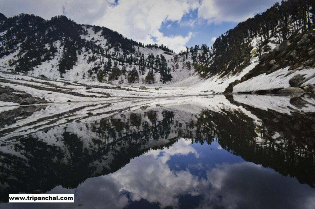
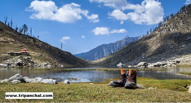
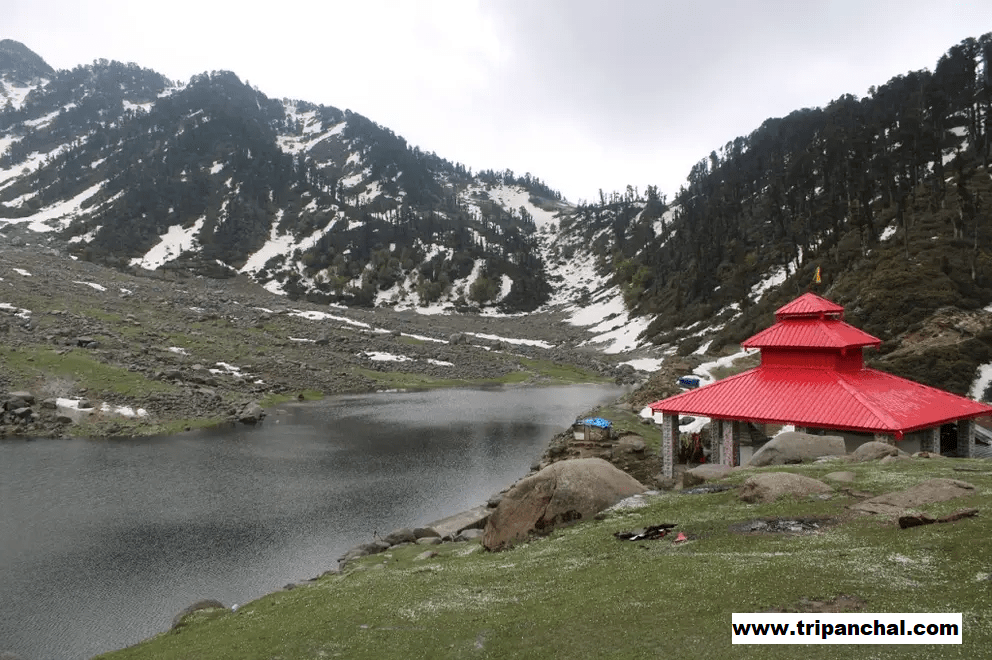
Minkiani Pass
Minkiani Pass Trek

Table of Contents

  1. Overview of Minkiani Pass
  2. Preparing for the Trek
    1. Gathering Essential Gear
    2. Physical Fitness and Training
  3. The Trekking Experience
    1. Day 1: Nioli village to Reoti Village
    2. Day 2: Reoti Village to Kareri lake Base Camp
    3. Day 3: Kareri lake Base Camp to Minkiani Base Camp
    4. Day 4: Minkiani Base Camp to Kareri lake Base Camp
    5. Day 5: Kareri lake Base Camp to Nioli village
  4. Flora and Fauna of Minkiani Pass
    1. Diverse Vegetation
    2. Rare and Endangered Wildlife
  5. Captivating Landscapes and Natural Wonders
    1. Majestic Snow-Capped Peaks
    2. Crystal Clear Glacial Lakes
    3. Serene Waterfalls
  6. The Cultural Heritage of the Region
    1. Indigenous Communities and Their Traditions
    2. Local Cuisine and Delicacies
  7. Challenges and Safety Measures
    1. Weather Conditions and Seasonal Considerations
    2. Altitude Sickness and Acclimatization
    3. Navigation and Trekking Etiquette

1. Overview of Minkiani Pass

Minkiani Pass is a breathtaking mountain pass located in the heart of the Himalayas, connecting two picturesque valleys. Situated at an altitude of 14,107 feet, this pass offers a challenging yet rewarding trekking experience for adventure enthusiasts. Renowned for its stunning vistas, rugged terrains, and cultural significance, Minkiani Pass has become a magnet for trekkers seeking an unforgettable journey amidst nature’s grandeur.

2. Preparing for the Trek

2.1 Gathering Essential Gear

Before embarking on the Minkiani Pass trek, having the right gear to ensure a safe and comfortable journey is crucial. Some essential items include sturdy hiking boots, waterproof clothing, a reliable backpack, a sleeping bag, trekking poles, and a first aid kit. It is advisable to consult experienced trekkers or local guides to create a comprehensive gear checklist.

2.2 Physical Fitness and Training

This trek demands a good level of physical fitness due to its challenging terrain and high altitude. Engaging in regular cardio exercises, strength training, and endurance-building activities like hiking or jogging can significantly improve your fitness level. Additionally, practicing yoga and meditation helps in enhancing mental resilience and concentration.
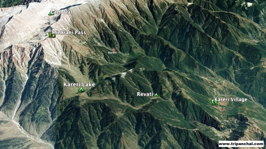
Minkiani Pass
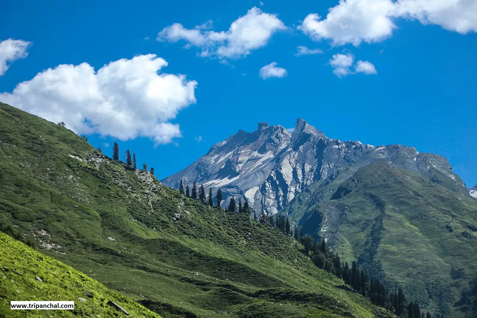
Trekking route of Minkiani Pass

3. The Trekking Experience

3.1 Day 1: Nioli village to Reoti Village

The adventure begins with a trek from the Nioli Village towards the first campsite. As you traverse through dense forests, be prepared to witness nature’s wonders in the form of flora, gurgling streams, and melodious bird calls. The first campsite provides a perfect setting for trekkers to rest and soak in the serenity of the surroundings.

3.2 Day 2: Reoti Village to Kareri lake Base Camp

Continuing the journey, day two takes you deeper into the wilderness. Trekking alongside pristine rivers and ascending gentle slopes, the second campsite awaits you with its breathtaking views of snow-capped peaks. The mesmerizing beauty of the landscape will leave you spellbound.

3.3 Day 3: Kareri lake Base Camp to Minkiani Base Camp

On day three, the trek becomes more challenging as you ascend higher altitudes. Crossing steep ridges and navigating rocky trails, trekkers experience a true test of endurance. However, the awe-inspiring panoramas and the sense of achievement propel you forward.

3.4 Day 4: Minkiani Base Camp to Kareri lake Base Camp

The most exhilarating part of the trek arrives as you approach the summit of Minkiani Pass. Scaling steep slopes and traversing glaciers, you are rewarded with breathtaking 360-degree views of the surrounding peaks. The feeling of standing atop the pass, with the wind brushing against your face, is nothing short of euphoric.

3.5 Day 5: Kareri lake Base Camp to Nioli village

The final leg of the trek takes you back to the Nioli Village, retracing your steps through the mesmerizing landscapes. As you bid farewell to Minkiani Pass, a profound sense of accomplishment and a treasure trove of memories accompany you on the descent.
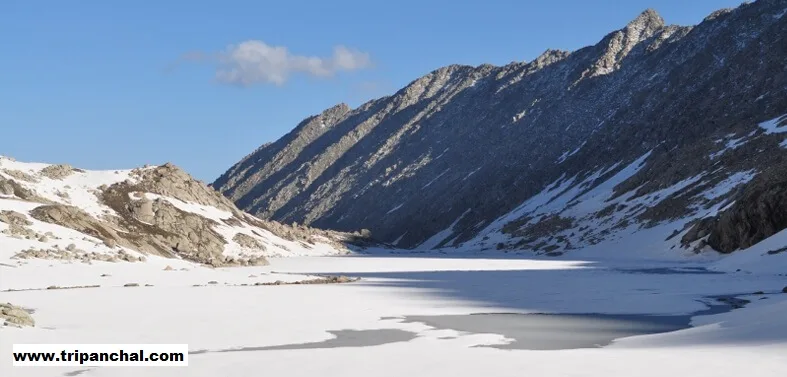
Minkiani Pass
Lam Dal Lake in June month

4. Flora and Fauna of Minkiani Pass

4.1 Diverse Vegetation

Minkiani Pass is blessed with a rich variety of vegetation, ranging from alpine forests to vibrant meadows adorned with wildflowers. Rhododendrons, junipers, and birch trees add splashes of color to the landscape, creating a picturesque setting for trekkers to immerse themselves in nature’s palette.

4.2 Rare and Endangered Wildlife

The region surrounding Minkiani Pass is home to a diverse array of wildlife. Trekkers may spot elusive Himalayan monals, ibex, snow leopards, and even the mighty Himalayan brown bear if fortunate. Witnessing these magnificent creatures in their natural habitat is an experience that leaves an indelible mark on any trekker’s heart.

5. Captivating Landscapes and Natural Wonders

5.1 Majestic Snow-Capped Peaks

One of the highlights of the Minkiani Pass trek is the breathtaking view of snow-capped peaks. Gazing at towering giants like Sickle moon peak, you are reminded of the grandeur and raw power of nature.

5.2 Crystal Clear Glacial Lakes

Enroute to Minkiani Pass, trekkers are blessed with the sight of crystal-clear glacial lakes reflecting the azure sky. These serene bodies of water, such as Lam dam lake, offer a tranquil spot to rest and rejuvenate amidst the surreal surroundings.

5.3 Serene Waterfalls

As you journey through Minkiani Pass, you’ll encounter enchanting waterfalls cascading down the mountainsides. The sound of rushing water and the misty spray create a refreshing atmosphere, providing a welcome respite from the challenging trek. Take a moment to bask in the beauty and serenity of these natural wonders.

6. The Cultural Heritage of the Region

6.1 Indigenous Communities and Their Traditions

Minkiani Pass not only boasts breathtaking landscapes but is also home to indigenous communities with rich cultural traditions. Interacting with the locals, you’ll get a glimpse into their way of life, customs, and traditions. Their warm hospitality and stories of survival in this harsh yet beautiful environment will leave a lasting impression on your trekking adventure.

6.2 Local Cuisine and Delicacies

No trekking experience is complete without savoring the local cuisine. Along the Minkiani Pass trek, you’ll have the opportunity to indulge in delicious regional delicacies. From hearty dal and rice to mouthwatering momos, the flavors of the Himalayas will tantalize your taste buds and fuel your journey.
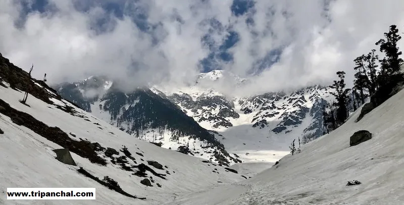
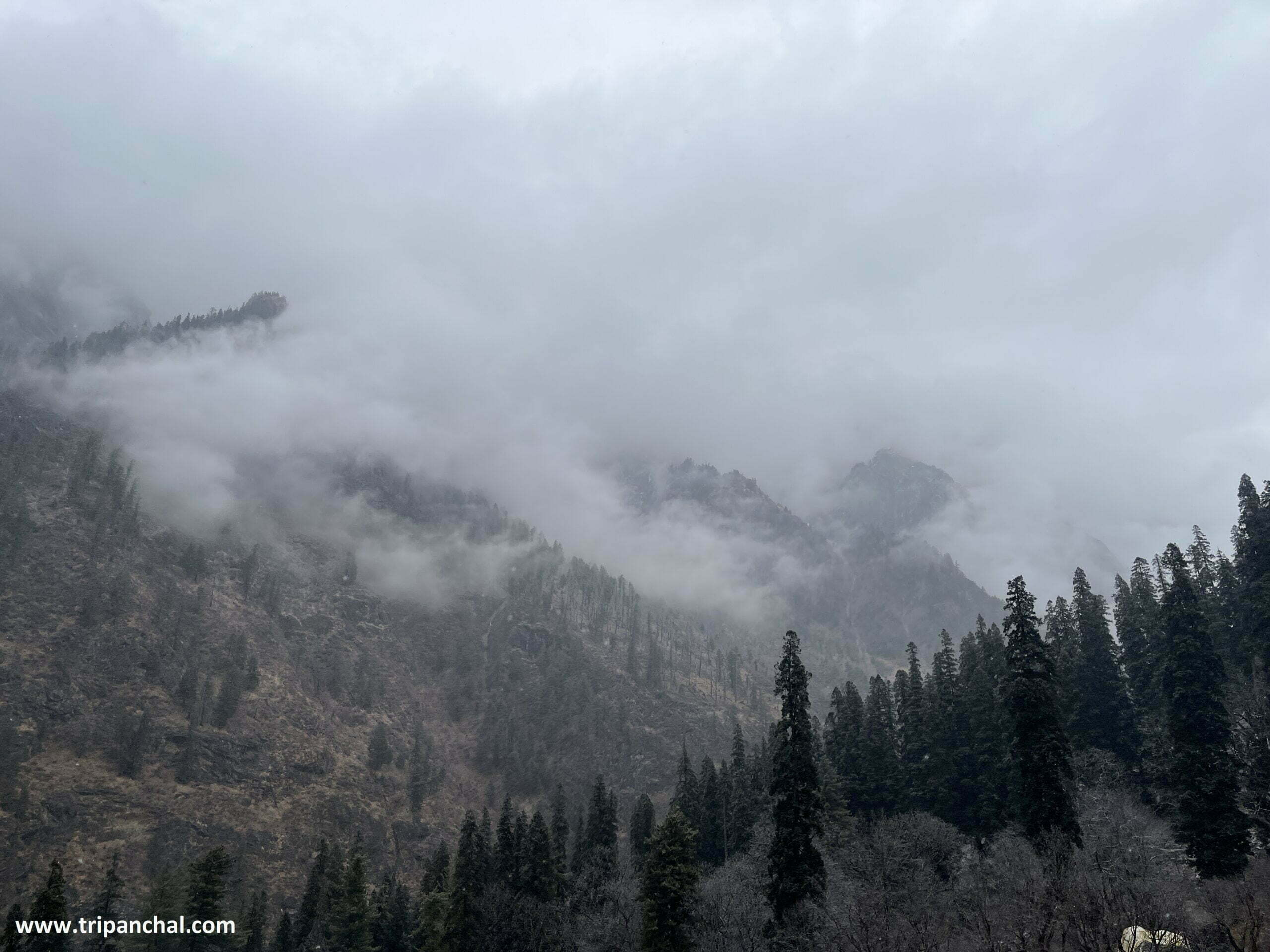
Minkiani Pass
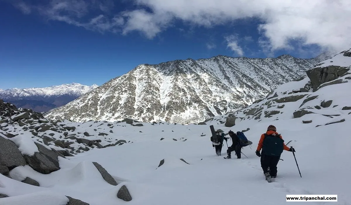
Minkiani Pass trek in winters

7. Challenges and Safety Measures

7.1 Weather Conditions and Seasonal Considerations

Minkiani Pass is subject to unpredictable weather conditions, making it essential to plan your trek carefully. The best time to undertake the trek is during the summer months when the weather is relatively stable. However, even during the favorable season, be prepared for sudden changes and pack appropriate clothing and gear to tackle rain, wind, and lower temperatures.

7.2 Altitude Sickness and Acclimatization

Due to the high altitude of Minkiani Pass, trekkers may experience symptoms of altitude sickness. It is crucial to allow your body time to acclimatize to the thin air and take necessary precautions. Stay hydrated, ascend gradually, and listen to your body’s signals. If symptoms worsen, descend to lower altitudes immediately and seek medical assistance if necessary.

7.3 Navigation and Trekking Etiquette

Navigating the Minkiani Pass trek requires a basic understanding of map reading and compass skills. Ensure you have a detailed map and familiarize yourself with the route before embarking on the journey. Additionally, practicing proper trekking etiquette, such as respecting the environment, minimizing waste, and staying on designated trails.

FAQs

Q1: Is prior trekking experience necessary to undertake the Minkiani Pass trek?

While prior trekking experience is beneficial, it is not mandatory. However, a good level of physical fitness and mental preparation is essential to tackle challenging terrain and high altitudes.

Q2: Are permits required to trek in Minkiani Pass?

No, trekkers no need to obtain the necessary permits but we suggested to take a local guide. He will safely guides you about the trekking route.

Q3: What is the best time to undertake the Minkiani Pass trek?

The ideal time to trek Minkiani Pass is during the summer months, from May to September when the weather is relatively stable. However, it is advisable to check the current weather conditions and plan accordingly.

Q4: How long does the Minkiani Pass trek typically take to complete?

The trek usually takes around 5 days to complete, including acclimatization days and rest stops at various campsites.

Q5: Are there any accommodation options available during the trek?

Accommodation during the trek primarily consists of camping in tents. Trekkers need to carry their camping equipment or hire them from trekking agencies.

Q6: Kareri lake to Minkiani Pass distance?

Approximately 07 kms from the Kareri Lake.

Q7: How to reach Minkiani Pass?

Take a bus from New Delhi/Chandigarh to Dharamshala, then take a local bus/taxi from Dharamshala to Ghera/Nioli Village, then start your trek from Nioli village.

Q7: How to reach Minkiani Pass from Mcleodganj?

Take a local bus/Auto/Taxi from Mcleodganj to Dharamshala bus stand, then take a HRTC bus/taxi from Dharamshala bus stand to Ghera/Nioli Village, then start your trek from Nioli village.

Things to keep in mind while traveling:

  • Do not roam alone at night. It’s not safe.
  • Respect Pahari culture and don’t argue/fight with people around you.
  • Do not litter in the mountains.
  • Save mountains, Save Nature.
  • Don’t do trekking with drugs.
  • Always carry a medical box, torchlight, trekking stick, trekking shoes, warm clothes, a raincoat, and a water bottle with you.
  • Always walk carefully and Do not trek in bad weather.

By clicking on the below link, you can book a room in the hostel/Camping according to your choice

Zostel Plus- Kareri

Zostel-Mcleod Ganj

The hosteller- Mall Road, Mcleod Ganj

The hosteller- Kareri Village

Cafe’s Nearby Mcleod Ganj

Shiva Cafe- Mcleod Ganj

Carpe Diem Restaurant

Jimmy Italian

Also Read: How to reach Kareri lake trek from Delhi

Dodital Darwa Pass Trek Uttarakhand 2023

  • Key Points: Dodital, Lord Ganesha’s Birthplace, Uttarkashi.
  • State: Uttarakhand, India.
  • Duration: 6 Night 7 Days.
  • Altitude: 3,657 m (11,998 feet).
  • Trek Distance: Approximately 40-50 km .
  • Summer temperature: (10°C to 18°C)
  • Winter temperature: (-10°C to -5°C)
  • Best Time To Visit: From April to October.
  • Trek Level: Difficult.
  • How to Reach: Take a bus from New Delhi to the Rishikesh ISBT, then take a government or local bus for Uttarkashi, then take a shared taxi for Sangam chatti. Which is the last motorable road to reach Dodital, and from Sangam chatti you can start the trek.
  • Budget: Under ₹8000 – ₹10000 per person.
  • Weather: In winter, Snow covers the peaks and in the summers you can experience a cool breeze.

Overview of the Dodital Darwa Pass Trek

Are you an adventurous soul seeking a thrilling trekking experience amidst the majestic landscapes of Uttarakhand? Look no further than the Dodital Darwa Pass Trek. This incredible trek takes you through picturesque valleys, serene lakes, and breathtaking mountain passes, offering an immersive experience in the lap of nature. In this article, we will provide you with a detailed day-wise itinerary for the Dodital Darwa Pass Trek, ensuring you make the most of this remarkable journey.

Dodital Darwa Pass Trek
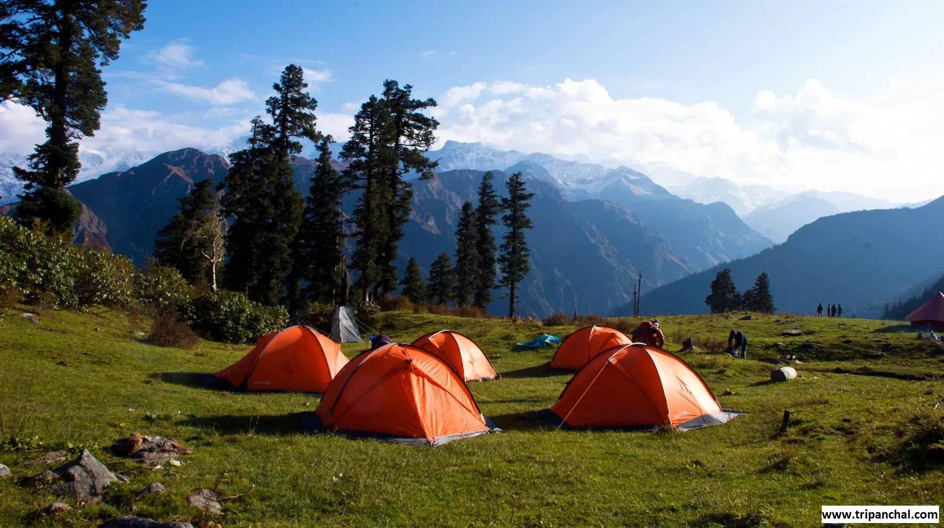
Camping Nearby Dodital Lake

Table of Contents

  1. Introduction
  2. Preparing for the Trek
  3. Day 1: Arrival in Uttarkashi
  4. Day 2: Uttarkashi to Sangam Chatti
  5. Day 3: Sangam Chatti to Dodital
  6. Day 4: Dodital to Darwa Top
  7. Day 5: Darwa Top to Bamsaru Khal
  8. Day 6: Bamsaru Khal to Agoda
  9. Day 7: Agoda to Sangam Chatti
  10. Day 8: Sangam Chatti to Uttarkashi

1. Introduction

The Dodital Darwa Pass Trek is a mesmerizing trail in the Uttarkashi district of Uttarakhand. It offers a perfect blend of adventure, natural beauty, and cultural exploration. This trek takes you through the scenic Dodital Lake, dense forests, and alpine meadows, and eventually leads to the breathtaking Darwa Pass. It is a difficult level trek that can be completed in around 6-7 days, covering approximately 40-50 kilometers.

2. Preparing for the Trek

Before embarking on the Dodital Darwa Pass Trek, thorough preparation is essential. Here are a few key points to consider:

  • Fitness: Engage in regular physical activities and exercises to improve stamina and endurance.
  • Acclimatization: Spend a day or two in Uttarkashi to acclimatize to the altitude and avoid any altitude-related health issues.
  • Packing: Carry essential trekking gear, including sturdy hiking boots, warm clothing, a waterproof backpack, a sleeping bag, trekking poles, and a first aid kit.
  • Permits: Obtain the necessary permits and permissions from the local authorities and check for any specific regulations or restrictions.
Dodital Darwa Pass Trek
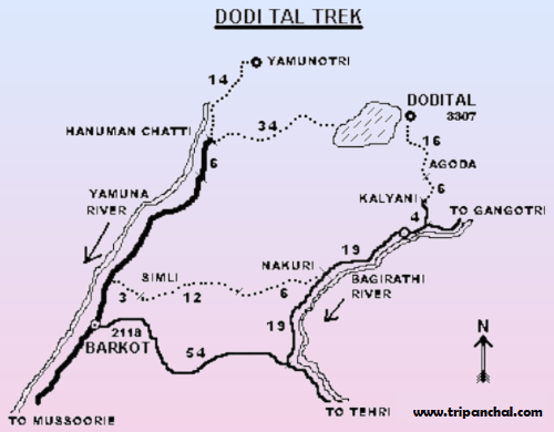
Dodital Lake trekking route

3. Day 1: Arrival in Uttarkashi

Your Dodital Darwa Pass Trek begins with your arrival in the charming town of Uttarkashi. Located on the banks of the Bhagirathi River, Uttarkashi is known for its ancient temples and serene surroundings. Spend the day exploring the town, visiting attractions like the Vishwanath Temple and Nehru Institute of Mountaineering.

4. Day 2: Uttarkashi to Sangam Chatti

On day 2, you will proceed towards Sangam Chatti, the starting point of the trek. The journey takes approximately 2-3 hours by road. After reaching Sangam Chatti, set up your camp and relax for a while. Take a short acclimatization hike to nearby villages and get acquainted with the local culture.

5. Day 3: Sangam Chatti to Dodital

This is an exciting day as you begin your trek toward the enchanting Dodital Lake. The trail takes you through dense forests, offering glimpses of various flora and fauna. After a moderate uphill climb, you will reach Dodital, a pristine freshwater lake surrounded by lush greenery. Set up camp near the lake, and spend the evening enjoying the tranquility of the surroundings.

6. Day 4: Dodital to Darwa Top

As the sun rises, prepare yourself for a challenging yet rewarding day. Trek from Dodital to Darwa Top, which offers breathtaking panoramic views of the Himalayan peaks. The trail takes you through rhododendron forests and alpine meadows, creating a picturesque setting. Reach Darwa Top and witness the awe-inspiring beauty of the snow-clad mountains. Camp overnight and soak in the serenity of the high-altitude environment.

7. Day 5: Darwa Top to Bamsaru Khal

Day 5 brings another exhilarating phase of the trek as you descend from Darwa Top to Bamsaru Khal. The trail presents a mix of steep slopes and gradual descents, offering a challenging yet thrilling experience. En route, you will pass through glistening streams and meadows adorned with vibrant flowers. After reaching Bamsaru Khal, set up camp and revel in the breathtaking mountain vistas.

8. Day 6: Bamsaru Khal to Agoda

On this day, bid farewell to the mesmerizing Bamsaru Khal and trek towards Agoda. The trail leads through picturesque landscapes, with the sound of gushing streams accompanying you. You will encounter lush green valleys and charming villages, providing insights into the local way of life. After reaching Agoda, set up camp and spend a peaceful night under the starry sky.

9. Day 7: Agoda to Sangam Chatti

As your memorable journey nears its end, trek back from Agoda to Sangam Chatti. Relish the familiar trails and relive the delightful experiences encountered during the trek. Once you reach Sangam Chatti, bid adieu to the serene mountains and retreat to the campsite. Celebrate the successful completion of the trek with your fellow trekkers and share stories by the campfire.

10. Day 8: Sangam Chatti to Uttarkashi

The final day marks your return to Uttarkashi. After breakfast, embark on a scenic drive from Sangam Chatti to Uttarkashi. On reaching Uttarkashi, take some time to relax, rejuvenate, and reflect upon the incredible journey you have undertaken. Explore the local markets and savor the delicious cuisine of Uttarakhand, known for its flavorsome regional dishes.

Dodital Darwa Pass Trek
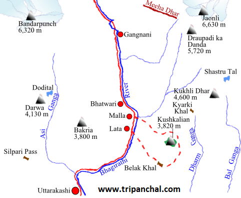
Dodital Lake trekking map

FAQs

Q1: Is prior trekking experience necessary for the Dodital Darwa Pass Trek?

No, prior trekking experience is not mandatory. However, it is recommended to have basic fitness and stamina to undertake this moderate-level trek.

Q2: What is the best time to undertake the Dodital Darwa Pass Trek?

The best time for this trek is during the summer months of May to June and the autumn months of September to October, when the weather is pleasant and the trails are in good condition.

Q3: Are there any accommodation facilities available during the trek?

Accommodation during the trek is in the form of camping. You will need to carry your own tents and sleeping bags or you can do camping by paying a charge on a per-night basis.

Q4: Is it safe to drink water from streams during the trek?

It is advisable to carry your own water or use water purification tablets or filters. Drinking water from streams without purification can lead to waterborne illnesses.

Q5: Are porters or guides available for the trek?

Yes, you can hire porters or guides from Uttarkashi or through trekking agencies. They can assist you with carrying your backpack and navigating the trail.

Q6: Is camping gear available for rent in Uttarkashi?

Yes, there are several shops and rental services in Uttarkashi where you can rent camping gear, including tents, sleeping bags, and trekking poles. It’s advisable to book in advance during the peak trekking season.

Q7: What is the level of difficulty of the Dodital Darwa Pass Trek?

The Dodital Darwa Pass Trek is considered a moderate-level trek. While it does require a decent level of fitness and stamina, it is achievable for individuals with basic trekking experience and a determined mindset.

Q8: Are there any medical facilities available during the trek?

Medical facilities are limited along the trekking route. It’s important to carry a basic first aid kit with essential medications and consult a doctor before embarking on the trek. In case of any emergency, evacuation can be arranged from Uttarkashi.

Q9: Can solo trekkers join organized groups for the Dodital Darwa Pass Trek?

Yes, solo trekkers can join organized trekking groups that are led by experienced guides. It not only enhances safety but also provides an opportunity to meet fellow trekkers and share the adventure.

Q10: Are there any age restrictions for the Dodital Darwa Pass Trek?

While there are no specific age restrictions, it’s important to consider the physical fitness and endurance level required for the trek. It is advisable for individuals above the age of 15 with a good level of fitness to undertake this trek.

Q11: How to reach Dodital?

Take a bus from New Delhi to the Rishikesh ISBT, then take a government or local bus for Uttarkashi, then take a shared taxi for Sangam chatti. Which is the last motorable road to reach Dodital, and from Sangam chatti you can start the trek.

Q12: Where is Dodital Lake?

The Dodital Lake trek is a mesmerizing trail in the Uttarkashi district of Uttarakhand. It offers a perfect blend of adventure, natural beauty, and cultural exploration. This trek takes you through the scenic Dodital Lake, dense forests, and alpine meadows, and eventually leads to the breathtaking Darwa Pass.

Dodital Darwa Pass Trek
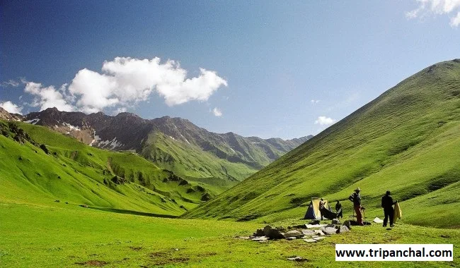
Beautiful Bugyals (Grasslands) nearby Dodital Trek

Plan your trip with tripanchal

Thank you for taking the time to read this detailed day-wise itinerary article on the Dodital Darwa Pass Trek in Uttarakhand. We hope this guide has provided you with valuable insights and information to plan your adventure. Remember to make the necessary preparations, follow safety guidelines, and respect the pristine environment throughout your trek.

Embark on this journey of a lifetime, where each day unveils new wonders and challenges, leaving you with memories that will be etched in your heart forever. The Dodital Darwa Pass Trek awaits you with open arms, ready to offer you a profound connection with nature and a sense of accomplishment.

So, gather your courage, pack your backpack, and set forth on this incredible trekking experience. Explore the untouched beauty of Uttarakhand, immerse yourself in the grandeur of the Himalayas, and create lifelong memories in the company of nature’s magnificence.

Remember, the mountains are calling, and it’s time for you to answer. Are you ready to embark on this remarkable adventure? Lace up your boots, take the first step, and let the magic of the Dodital Darwa Pass Trek unfold before your eyes.

Things to keep in mind while traveling:

  • Do not roam alone at night. It’s not safe.
  • Respect Pahari culture and don’t argue/fight with people around you.
  • Do not litter in the mountains.
  • Save mountains, Save Nature.
  • Don’t do trekking with drugs.
  • Always carry a medical box, torchlight, trekking stick, trekking shoes, warm clothes, a raincoat, and a water bottle with you.
  • Always walk carefully and Do not trek in bad weather.

By clicking on the below link, you can book a room in the homestay/Camping according to your choice

Dodital Riverside camping bebra

Adventure Camp

Panwar Camping bebra

Buransh Camps

Cafe’s Nearby Dodital Lake Trek

Bhala Ho Cafe & Homestay

Maa Durga Bhojanalya

Cafe On the Lake

Also Read: How to reach Kheerganga from Delhi
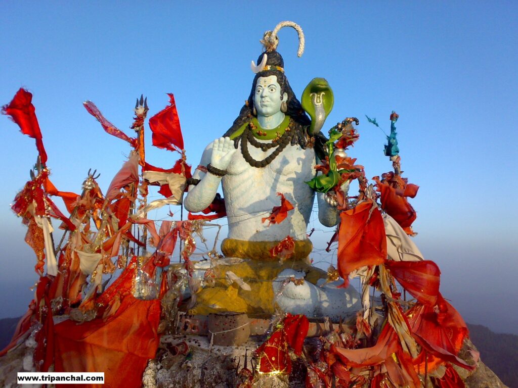
Prashar Lake Trek: Pristine Beauty of the Himalayas

  • Key Points: Prashar Lake, Prashar Lake Trek, Mandi Town.
  • State: Himachal Pradesh, India.
  • Duration: 2 Night 2 Days.
  • Altitude: 2,730 m (8,957 feet).
  • Trek Distance: Approximately 8 km.
  • Summer temperature: (15°C to 25°C)
  • Winter temperature: (-2°C to 5°C)
  • Best Time To Visit: From April to November.
  • Trek Level: Easy Level.
  • How to Reach: Take a bus from New Delhi/Chandigarh to the Mandi bus stand then take a local taxi from Mandi to Baggi village and from Baggi village you can start the trek.
  • Budget: Under ₹5000 per person.
  • Weather: In winter, Snow covers the peaks and in the summers you can experience a cool breeze.

Introduction to the Prashar Lake Trek

Hey there! Are you ready for an incredible adventure amidst the breathtaking Himalayas? Today we will tell you about the hidden beauty of Prashar Lake Trek in the Kullu Valley of Himachal Pradesh, India. This trek is a perfect escape for nature lovers and adventure enthusiasts seeking a serene getaway. Get ready to be captivated by the stunning landscapes, immerse yourself in the local culture, and experience the magic of Prashar Lake. Let’s dive into the details and embark on this unforgettable journey!

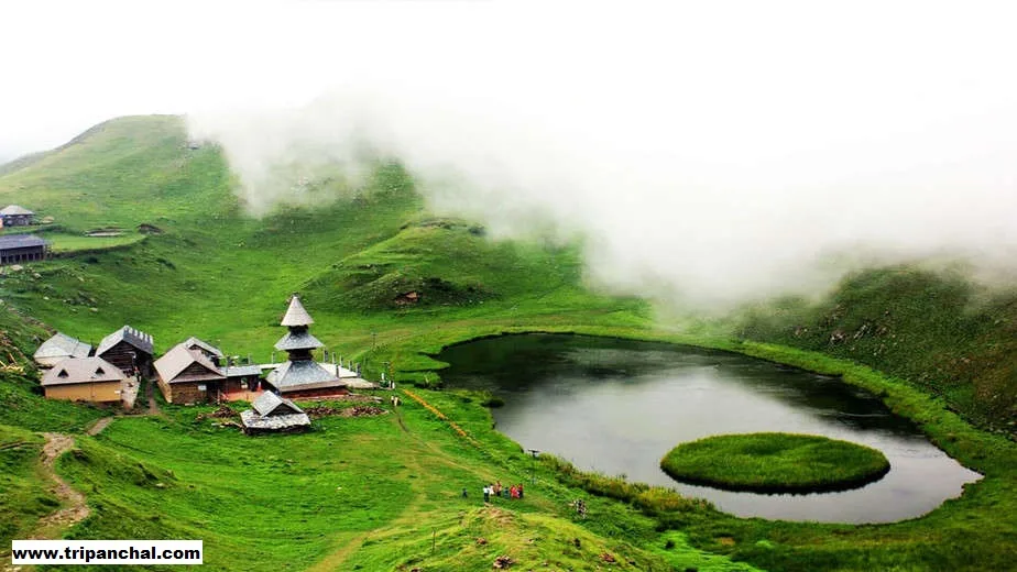
Prashar lake trek
Prashar lake trek in Monsoon Season

Table of Contents

  1. Overview of Prashar Lake Trek
  2. Route and Itinerary
  3. Difficulty Level and Fitness Requirements
  4. Best Time to Visit
  5. Rules and Regulations
  6. What to Pack for the Trek
  7. Accommodation Options
  8. Food and Water Availability
  9. Safety Tips and Precautions
  10. Highlights and Attractions
  11. Cultural Significance of Prashar Lake
  12. Fauna and Flora
  13. Photography Opportunities
  14. Nearby Attractions and Side Trip

1. Overview of Prashar Lake Trek

Let’s kick off our adventure with an overview of the Prashar Lake Trek. This trek takes you on a spiritual journey through the Himalayas. You’ll start from the charming village of Baggi, trek through lush forests and picturesque landscapes, and finally reach the pristine Prashar Lake. The lake, situated at a mesmerizing altitude of 8,960 feet, offers panoramic views of snow-capped peaks and a sense of tranquility that will leave you spellbound.

2. Route and Itinerary

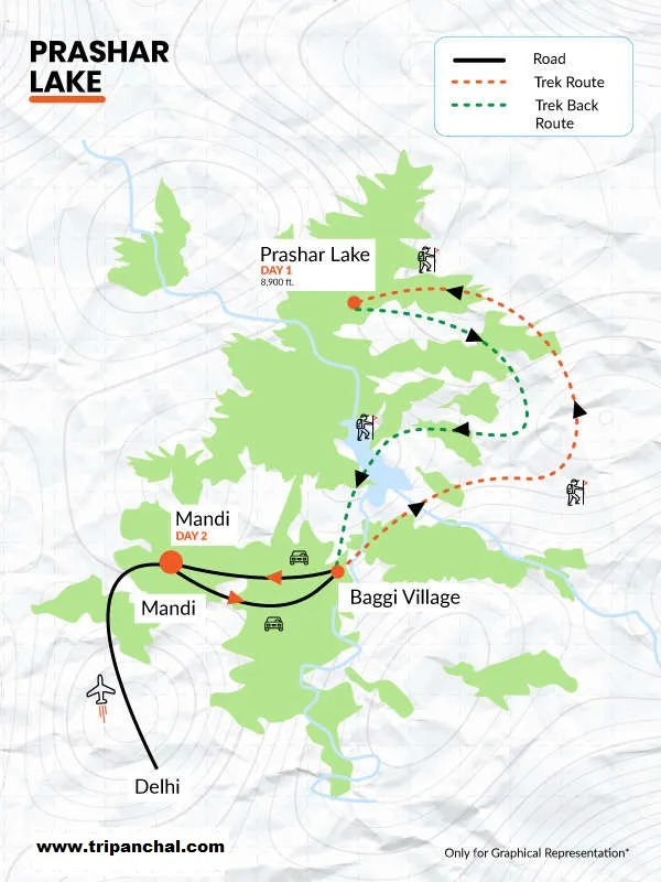
Embarking on the Prashar Lake Trek is a thrill in itself. The journey begins from Baggi village, where you’ll find friendly locals ready to guide you. The well-marked trail will lead you through enchanting forests adorned with oak, cedar, and pine trees. As you make your way, you’ll cross charming wooden bridges and catch glimpses of the local way of life. After a few hours of trekking, you’ll arrive at the beautiful campsite near Prashar Lake, where you can set up your tents and soak in the peaceful atmosphere.

Prashar lake trek
Prashar Lake Trek Map

3. Difficulty Level and Fitness Requirements

Worried about the trek’s difficulty? Don’t be! The Prashar Lake Trek is suitable for both beginners and experienced trekkers. It offers a moderate level of challenge with gradual ascents and a few steeper sections. To enjoy the trek to the fullest, it’s good to have a reasonable level of fitness. Engaging in regular physical exercises and cardio workouts before the trek will help you prepare for the adventure. Don’t worry if you’re new to hiking – this trek is perfect for you!

4. Best Time to Visit

When should you plan your Prashar Lake Trek? The best time is during the summer and autumn months, from April to November. The weather temperatures are ranging from 15 to 25 degrees Celsius. The summer months provide a cool climate, while autumn paints the surrounding foliage with vibrant colors. It’s the perfect time to enjoy the beauty of nature and create memories that will last a lifetime.

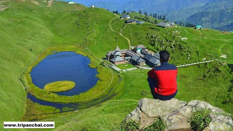
Prashar lake trek
Stunning View of Prashar Lake

5. Rules and Regulations

Remember to carry valid identification proof along with you during the trekking time. Adhering to the rules and regulations set by the authorities is crucial to preserve the natural ecosystem and maintain the serenity of the place.

6. What to Pack for the Trek

Now, let’s talk about what you should pack for the trek. Here’s a handy checklist:

  • Sturdy hiking boots for comfortable walking
  • A backpack with a rain cover to keep your belongings dry
  • Warm and waterproof clothing to tackle the changing weather
  • A cozy sleeping bag and camping gear for a good night’s rest
  • Trekking stick for stability and support
  • A reusable water bottle for filling the drinking water
  • A basic first aid kit for any emergencies
  • Delicious snacks and energy bars to keep you fueled
  • Sunscreen and Odomos to protect your skin
  • A headlamp or flashlight for nighttime adventures
  • A camera to capture the breathtaking views

7. Accommodation Options

During the trek, you have two options for accommodation. You can choose to camp at the designated campsites near Prashar Lake, where you’ll find basic facilities such as tents and sleeping bags. Camping under the starry sky amidst the serene surroundings is an experience you won’t forget. Alternatively, if you prefer a more comfortable stay, there are guesthouses and homestays available in nearby villages like Baggi and Bajaura.

8. Food and Water Availability

While trekking, it’s important to keep yourself well-fed and hydrated. Along the trail, you’ll find limited options for food and water. It’s a good idea to carry your own food supplies, including dry fruits, energy bars, and snacks. Don’t forget to pack enough drinking water or water purification tablets to quench your thirst. At the campsite near Prashar Lake, the camp organizers will serve you delicious local Himachali cuisine, adding a touch of flavor to your trekking adventure.

9. Safety Tips and Precautions

Your safety is your priority. Here are some essential safety tips you have to follow :

  • Take regular breaks to acclimatize yourself to the high altitude.
  • Stay hydrated by drinking mineral water or energy drink.
  • Follow the instructions of your guide.
  • Inform your family and friends about your trekking plans and itinerary.
  • Respect the local culture and traditions.

10. Highlights and Attractions

Get ready for the highlights and attractions of the Prashar Lake Trek! Here’s what awaits you:

  • Prashar Lake: A pristine alpine lake with crystal-clear waters and breathtaking views.
  • Pagoda Temple: A unique three-storied pagoda-style temple dedicated to the sage Prashar.
  • Dhauladhar Range: Majestic snow-capped peaks that create a stunning backdrop for the lake.
  • Local Villages: Charming Himalayan villages where you can experience the warmth of the locals.
  • Breathtaking Landscapes: Spectacular vistas of lush green valleys, meadows, and snow-covered mountains.

11. Cultural Significance of Prashar Lake

Prashar Lake holds immense cultural significance among the local population. According to legend, the lake is the sacred abode of Sage Prashar. The beautiful pagoda temple standing beside the lake is dedicated to him. Many devotees visit the temple to seek blessings and pay homage to the revered sage. The serene ambiance of the lake and its surroundings creates a peaceful and spiritual atmosphere, perfect for self-reflection and introspection.

12. Fauna and Flora

The region around Prashar Lake is blessed with rich biodiversity. As you trek through the forests, you’ll encounter a variety of flora and fauna. The forests are home to oak, cedar, and pine trees, creating a green canopy overhead. Keep an eye out for colorful birds, playful squirrels, and other small animals. The harmony between nature and wildlife will leave you in awe.

13. Photography Opportunities

Calling all photography enthusiasts! The Prashar Lake Trek offers endless opportunities to capture stunning shots. From the picturesque landscapes to the shimmering lake and the majestic Himalayan peaks, every frame is a work of art. Don’t forget to pack your camera and preserve these precious moments forever.

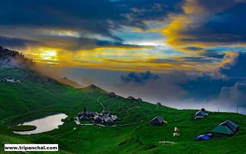
Prashar lake trek
Sunset View at Prashar Lake

14. Nearby Attractions and Side Trips

If you have extra time, consider exploring the nearby attractions and taking side trips. The Kullu Valley is a treasure trove of natural beauty and cultural heritage. You can visit the famous town of Manali, indulge in adventure activities like river rafting, or explore the ancient temples and monasteries in the region. Each experience will add more depth to your journey.

FAQs

Q1: How to go to Prashar Lake from Delhi?

Take a bus from New Delhi/Chandigarh to the Mandi bus stand then take a local taxi from Mandi to Baggi village and from Baggi village you can start the trek.

Q2: How to reach Prashar Lake from Mandi?

Take a taxi or sharing Cab from ISBT Mandi to Baggi village then from Baggi village you can start the trek.

Q3: Where is Prashar Lake?

It is situated at an altitude of 2,730 m from sea level in the Mandi district of Himachal Pradesh. It is approximately 53 km north of Mandi town.

Q5: Why Prashar Lake is so famous?

According to ancient Hindu mythology, Prashar Lake derives its name from the revered sage Prashar. The tale dates back to the times of the epic Mahabharata, making it steeped in history and mystique. Sage Prashar, known for his wisdom and spiritual prowess, meditated in these very mountains, seeking enlightenment and divine blessings.

Legend has it that Sage Prashar, with his divine powers, created the beautiful lake as a gift to the local villagers. It is said that he struck his staff on the ground, and a crystal-clear water body emerged, reflecting the azure sky above and the towering peaks surrounding it. The lake, with its perfectly circular shape, is believed to be a symbol of the sage’s mystic power and connection with the divine.

Q6: Where to stay at Prashar Lake?

Yes, there are some accommodation options available at Prashar Lake, ranging from homestays to camping. However, it is advisable to book in advance, especially during the peak season, to ensure availability. The booking link is available in the blog. Please check below.

Q7: Is trek to Prashar Lake difficult?

No, the Prashar Lake trek is classified as an easy-level trek but still, it requires a certain level of physical fitness and endurance.

Q8: What is the Prashar Lake Trek distance?

The trek starts from the small village of Baggi, which is accessible by road from the town of Mandi. Covering a distance of about 8 kilometers, the trek usually takes 4-5 hours to complete.

Q9: Best time to visit Prashar Lake?

The spring season (April to June) brings blooming flowers, while the autumn season (September to November) offers vibrant foliage and a post-monsoon freshness to the surroundings. It is advisable to avoid visiting during the monsoon season (July and August) as heavy rainfall can make the trekking trail slippery and unsafe. By planning your visit during the recommended months, you can fully enjoy the pristine beauty of Prashar Lake and have a memorable trekking experience.

Q10: Mandi to Prashar Lake distance?

It is approximately 53 km north of Mandi town.

Things to keep in mind while traveling:

  • Do not roam alone at night. It’s not safe.
  • Respect Pahari culture and don’t argue/fight with people around you.
  • Do not litter in the mountains.
  • Save mountains, Save Nature.
  • Don’t do trekking with drugs.
  • Always carry a medical box, torchlight, trekking stick, trekking shoes, warm clothes, a raincoat, and a water bottle with you.
  • Always walk carefully and Do not trek in bad weather.

By clicking on the below link, you can book a room in the homestay/Camping according to your choice

Forest Department Guest house

Icy Mountains Camping

Apple Garden Camping

HP Forest Department VIP Guest House

Krishna Camp Prashar Lake

Cafe’s Nearby Prashar Lake Trek

Prashar Valley Dhaba

Kishna Cafe

Cafe one Love

Other Details

  • To book the PWD guest house, Please contact 01905222151 or email EE-Mandiv1@hp.nic.in
  • To book the forest guest house, contact DFO office Mandi at 01905235360 or RFO Kataula at 01905269469. Otherwise, you can also contact the caretaker Mr. Roop Singh at 09418411746
  • Prashar Guest House- 9816669256
  • Sri Prashar Homestay- 9805371061
  • Hill View Homestay- 9418044003, 9816244003

Also Read: How to reach Kheerganga from Delhi
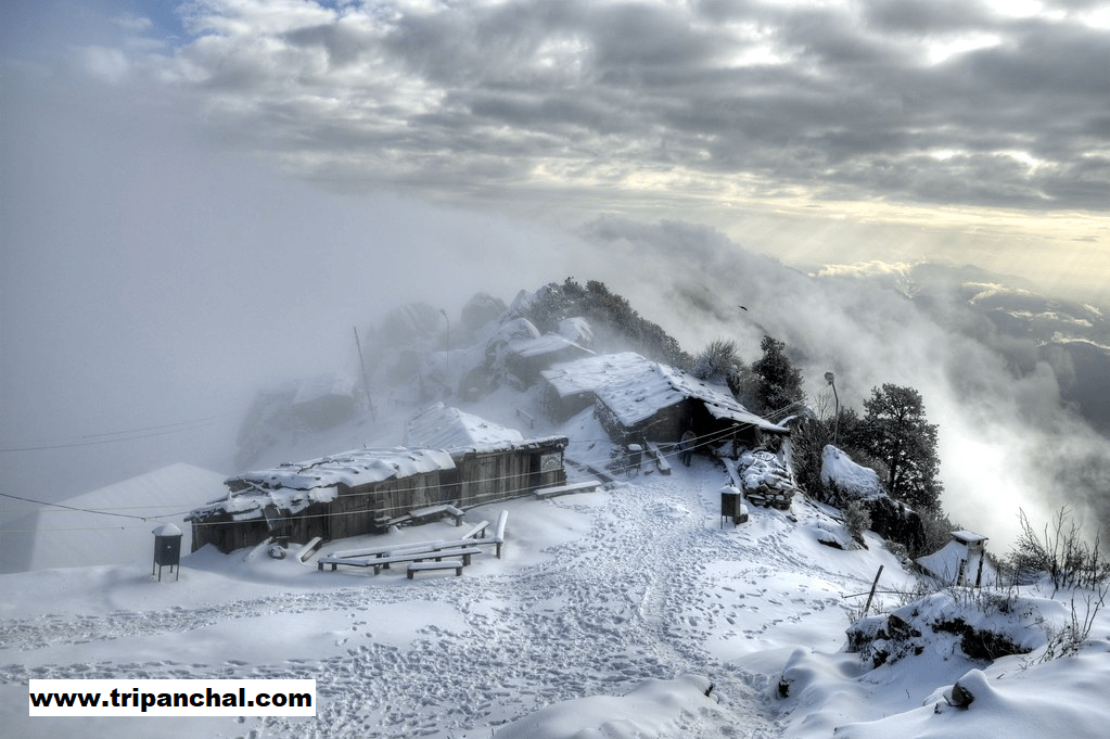
What is the distance between Manali to Bhrigu Lake?

  • Key Points: Bhrigu Lake Trek, Bhrigu Lake, Manali.
  • State: Himachal Pradesh, India.
  • Duration: 3 Nights 4 Days.
  • Altitude: 4,267 m (14,009 feet).
  • Trek Distance: Approximately 22 km.
  • Summer temperature: (15°C to 25°C)
  • Winter temperature: (-5°C to 10°C)
  • Best Time To Visit: From May to October.
  • Trek Level: Moderate.
  • How to Reach: Take a local bus/taxi from New Delhi or Chandigarh ISBT to the Manali bus stand then take a taxi from Manali to Gulaba and from Gulaba you can start the trek.
  • Budget: ₹8,000-₹10,000 per person.
  • Weather: In winter, Snow covers the peaks and in the summers you can experience a cool breeze.

Introduction to the Bhrigu Lake Trek

Get ready to embark on an incredible adventure as we introduce you to the distance between Manali to Bhrigu Lake. Located in the Kullu district of Himachal Pradesh, India, this trek is named after Sage Bhrigu, who is said to have meditated near the serene lake. The journey begins from the beautiful town of Manali, known for its picturesque charm and pleasant weather. As you trek towards Bhrigu Lake, you’ll be greeted by crystal-clear waters and the magnificent snow-capped peaks of the Himalayas.

distance between Manali to Bhrigu Lake
Bhrigu Lake Trek, Manali (Himachal Pradesh)

Overview of Bhrigu Lake Trek

Where to find the magic: Location and Accessibility

To kickstart your Bhrigu Lake Trek, head to Gulaba, a village located approximately 22 kilometers away from Manali. The good news is that Manali is well-connected by road, making it easily accessible from major cities across India. From Gulaba, get ready to immerse yourself in the wonders of nature as you venture through lush green meadows, dense forests, and captivating landscapes that offer breathtaking views of the Himalayan range.

Altitude, Duration, and Best Time to Visit

As you make your way to the top, you’ll reach the magnificent Bhrigu Lake, perched at an impressive altitude of 4,300 meters. The entire trek covers a distance of around 30 kilometers and usually takes 3 to 4 days to complete, depending on your pace and acclimatization. The best time to experience the Bhrigu Lake Trek is between May and October when the weather is pleasant, and the trekking trails are not obstructed by heavy snow. During this period, you can expect comfortable temperatures ranging from 10 to 20 degrees Celsius during the day and around 5 degrees Celsius at night.

Preparing for Bhrigu Lake Trek

Before embarking on this exciting journey, it’s important to prepare yourself adequately. Here are some essential factors to consider:

Get in Shape: Physical Fitness and Health Considerations

The Bhrigu Lake Trek falls into the moderate difficulty category, so it’s a good idea to ensure you’re physically fit. Engaging in regular exercise, including cardiovascular activities and strength training, will help prepare your body for the trek. It’s always wise to consult a healthcare professional before undertaking any high-altitude trek to ensure that you’re in good health and don’t have any medical conditions that could pose a risk during the trek.

Pack Like a Pro: Essential Gear and Equipment

To make the most of your trekking adventure, make sure to pack the right gear and equipment. Essential items include sturdy trekking boots, comfortable and layered clothing to tackle changing weather conditions, a waterproof jacket, sunscreen to protect your skin, a hat to shield you from the sun, sunglasses, a cozy sleeping bag, a first-aid kit, a reliable headlamp, and a reusable water bottle. Don’t forget to pack some energizing snacks and sufficient water to keep you fueled throughout the trek.

Crossing the Treks: Permits and Permissions

Before embarking on the Bhrigu Lake Trek, it’s important to obtain the necessary permits and permissions. Check with local authorities or consider hiring a trekking agency to assist you in obtaining the required permits and ensure compliance with local regulations. This will ensure a smooth and hassle-free experience during your trek.

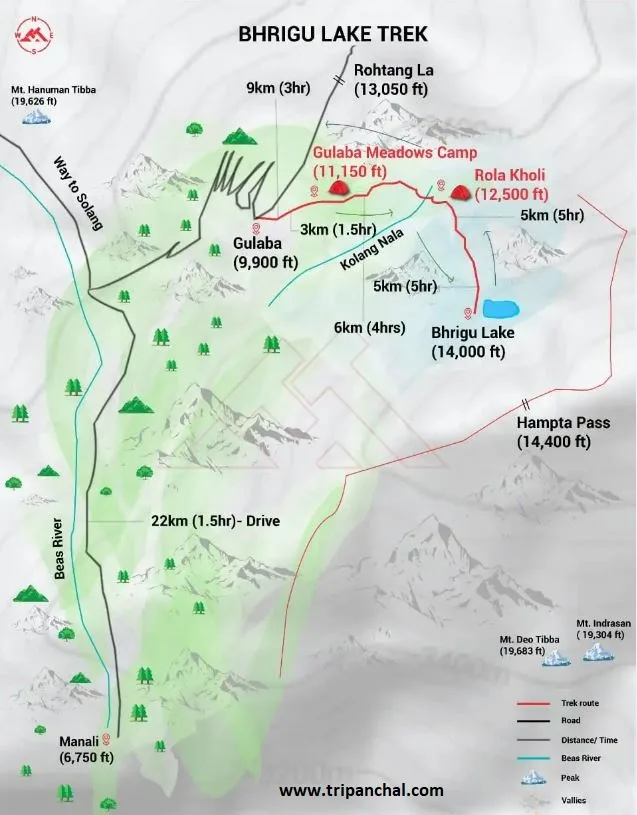
How to cover the distance between Manali to Bhrigu Lake

Get ready to follow the path less traveled as we guide you through the mesmerizing trekking route to Bhrigu Lake. Let’s break it down day by day:

Day 1: Manali to Gulaba

Your adventure begins with a scenic drive from Manali to Gulaba, treating you to breathtaking views of majestic mountains and valleys. The journey takes around one and a half hours, allowing you to soak in the beauty of the surroundings. Once you reach Gulaba, take some time to acclimatize and explore the picturesque village.

Day 2: Gulaba to Rola Kholi

On the second day, lace up your boots and hit the trail from Gulaba to Rola Kholi. The route takes you through dense forests adorned with oak, pine, and cedar trees, providing a refreshing and tranquil atmosphere. After a few hours of trekking, you’ll arrive at Rola Kholi, a stunning camping site surrounded by lush meadows.

Day 3: Rola Kholi to Bhrigu Lake and back

Prepare for the most exhilarating day of your trek as you ascend towards Bhrigu Lake. The trail treats you to panoramic views of snow-covered peaks and the valley below. Once you reach Bhrigu Lake, take a moment to revel in its breathtaking turquoise blue waters. After immersing yourself in the beauty of the lake, begin your descent back to Rola Kholi, where you’ll spend the night, relishing the memories of the day.

Day 4: Rola Kholi to Gulaba and Return to Manali

On the final day of your trek, retrace your steps back to Gulaba, savoring the mesmerizing landscapes one last time. From Gulaba, you’ll be driven back to Manali, bidding farewell to the majestic mountains and carrying cherished memories of your Bhrigu Lake Trek.

distance between Manali to Bhrigu Lake
Distance between Manali to Bhrigu Lake

Highlights of the distance between Manali to Bhrigu Lake

Prepare to be enchanted as the Bhrigu Lake Trek unfolds before your eyes, offering a multitude of highlights that will leave you in awe. Here are some of the key highlights you can expect:

Nature’s Masterpieces: Scenic Beauty and Himalayan Landscapes

The Bhrigu Lake Trek immerses you in breathtaking views of snow-clad peaks, lush green meadows, gushing streams, and captivating valleys. The ever-changing beauty of nature will keep you spellbound throughout the trek, making every step a memorable experience.

Nature’s Companions: Flora and Fauna

As you explore the trekking trail, keep an eye out for the diverse flora and fauna that call this region home. From vibrant flowers to rare species of birds and animals, the Bhrigu Lake Trek is a paradise for nature enthusiasts and wildlife lovers.

Cultural Connections: Interactions and Local Experiences

The Bhrigu Lake Trek offers opportunities for cultural interactions with the local communities along the way. Engage with the warm and welcoming locals, learn about their traditions, taste the local cuisine, and gain insights into the rich cultural heritage of the region.

distance between Manali to Bhrigu Lake
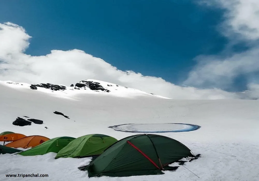
Camping at Bhrigu Lake

Tips for a Successful Bhrigu Lake Trek

To ensure a successful and enjoyable Bhrigu Lake Trek, here are some valuable tips to keep in mind:

Altitude Matters: Acclimatization and Hydration

As you ascend to higher altitudes, it’s crucial to acclimatize properly. Take it slow, listen to your body, and allow yourself time to adjust to the altitude. Stay hydrated by drinking plenty of water throughout the trek to prevent altitude-related issues.

Pack Light and Right: Essentials and Safety

When packing for the trek, remember to keep your backpack light and pack only the essentials. Carry necessary items such as your identification, permits, appropriate clothing, comfortable footwear, first-aid kit, and toiletries. Don’t forget to bring a positive attitude and a spirit of adventure!

Respect Nature and Leave No Trace

As responsible trekkers, it’s important to respect the environment and leave no trace. Dispose of waste properly, avoid littering, and follow the principles of Leave No Trace to preserve the pristine beauty of the mountains for future generations.

distance between Manali to Bhrigu Lake
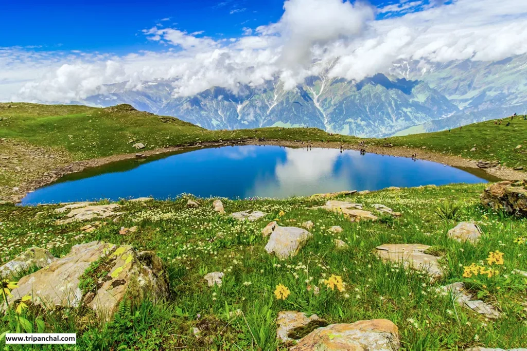
Stunning view of Bhrigu Lake

Conclusion

Embarking on the Bhrigu Lake Trek is like stepping into a dreamland where nature unfolds its wonders at every turn. From the picturesque landscapes to the captivating beauty of Bhrigu Lake, this trek promises an unforgettable adventure. So, gather your courage, prepare yourself, and get ready to create memories that will last a lifetime.

FAQs

Q1: Is prior trekking experience necessary for the Bhrigu Lake Trek?

No, prior trekking experience is not necessary for the Bhrigu Lake Trek. However, it’s advisable to be physically fit and mentally prepared for the moderate difficulty level of the trek.

Q2: Are there any age restrictions for the Bhrigu Lake Trek?

There are no specific age restrictions for the Bhrigu Lake Trek. However, participants should be in good health and physically capable of undertaking the trek.

Q3: Are there any accommodation facilities available during the trek?

Accommodation during the Bhrigu Lake Trek is primarily in tents. Campsites are set up at designated locations along the trekking route, providing basic facilities for a comfortable stay amidst nature.

Q4: What kind of weather can I expect during the trek?

The weather during the Bhrigu Lake Trek can vary. It’s advisable to check the weather forecast before embarking on the trek and pack accordingly. Be prepared for changing weather conditions, including rain and chilly temperatures.

Q5: Can I hire a guide or join a trekking group for the Bhrigu Lake Trek?

Yes, you have the option to hire a guide or join a trekking group for the Bhrigu Lake Trek. Hiring a guide can enhance your trekking experience by providing local knowledge, ensuring safety, and taking care of logistics.

Get ready to embark on an unforgettable journey to Bhrigu Lake, where nature’s magic awaits you at every step. Experience the grandeur of the Himalayas, immerse yourself in breathtaking landscapes, and create memories that will last a lifetime.

Things to keep in mind while traveling:

  • Do not roam alone at night. It’s not safe.
  • Respect Pahari culture and don’t argue/fight with people around you.
  • Do not litter in the mountains.
  • Save mountains, Save Nature.
  • Don’t do trekking with drugs.
  • Always carry a medical box, torchlight, trekking stick, trekking shoes, warm clothes, a raincoat, and a water bottle with you.
  • Always walk carefully, Do not trek in bad weather.

By clicking on the below link, you can book a room in the Homestay according to your choice.

Nisarga Homestays

Leap of Nature Homestay

Cafe’s Nearby Bhrigu Lake Trek

Apidor Cafe

Manzil Cafe & Stay

Book a Package for Bhrigu Lake Trek

3D/2N Package for Bhrigu Lake Trek

The Beauty of Kheerganga Kasol: A Traveler’s Guide

  • Key Points: Kheerganga Trek, Barshaini, Parvati Valley.
  • State: Himachal Pradesh, India.
  • Duration: 2 Nights 3 Days.
  • Altitude: 2960 m (9711 feet).
  • Trek Distance: Approximately 13 km.
  • Summer temperature: (10°C to 15°C)
  • Winter temperature: (-5°C to 7°C)
  • Best Time To Visit: March – December.
  • Trek Level: Moderate level.
  • How to Reach: Take a bus from New Delhi/Chandigarh to Kasol, then take a local bus from Kasol bus point to Barshaini bus point, then from Barshaini bus point towards the Kalga village you can start your trek.
  • Budget: Under ₹6000 per person.
  • Weather: In winter, Snow covers the peaks and in the summers you can experience a cool breeze.
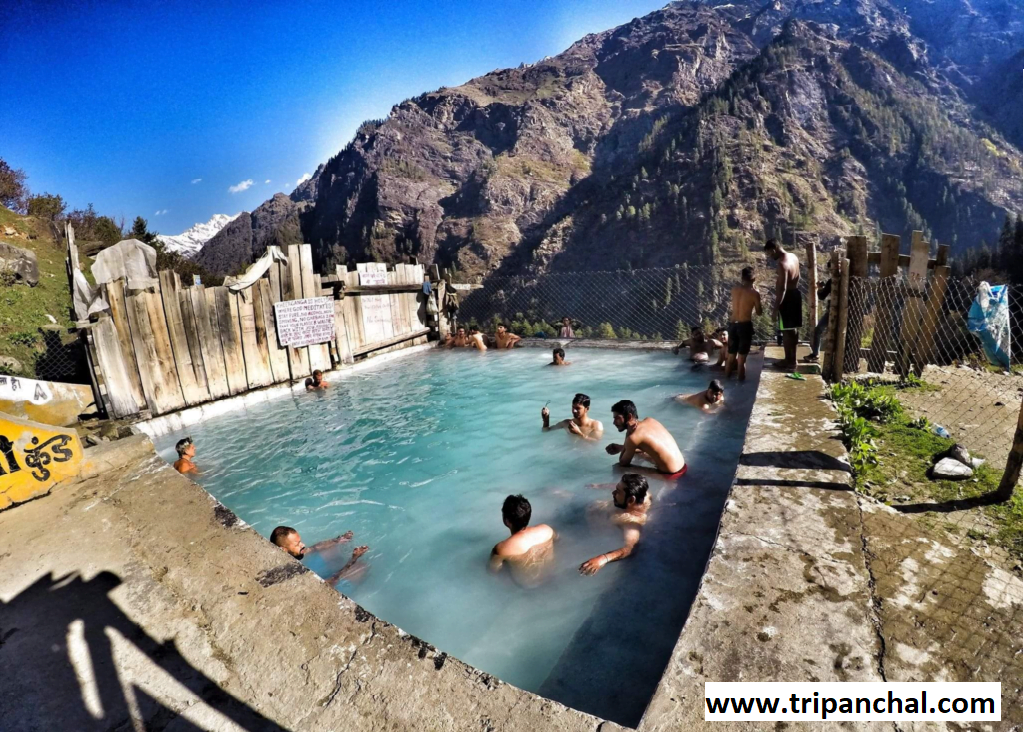
Kheerganga kasol
Hot water spring at kheerganga Kasol

Kheerganga Kasol Trek

It is one of the best treks in the Parvati valley region and it is located at an altitude of approximately 9,711 feet in the Parvati valley near barshaini village in the state of Himachal pradesh. The distance between barshaini and Kasol is about 15.5 kilometers, which can be covered in approx. 1 hour of traveling time. This Kheerganga Kasol trek is not easy for those who do not prefer to walk much or who are not used to physical activity.

About Kheerganga Kasol Trek

The Kheerganga Kasol trek is a must-visit destination for anyone who loves trekking and nature. The trek offers stunning views of the Himalayas, as well as a chance to relax and rejuvenate in a natural hot water spring. While it’s true that the trek demands a certain level of physical fitness and endurance, it is an experience that promises to create lifelong memories. Once you reach at the Kheerganga top, you will be greeted with stunning views of the surrounding mountains and dense forest. So, pack your bags and tighten your trekking shoes for an adventure of a lifetime with the Kheerganga trek.

Kheerganga kasol
Kheerganga Kasol trek in winters

The trek starts from the small village of Barshaini, which is accessible by road from the town of Kasol. It is the perfect place to disconnect yourself from the world and immerse in the natural beauty of the valley. During the trek, you will pass through dense forests, natural springs, and small villages before reaching Kheerganga, which marks the endpoint of the trek. Covering a distance of about 13 kilometers, the trek usually takes 5-6 hours to complete.

Information about the Kheerganga Kasol trek route

Right Now, there are two routes of kheerganga trek. One is via Kalga village and another one is via Nakthan village. Its totally up to you from where you want to go but we advise you to go via Kalga village and come back via same route. Because Nakthan village route is not good and there are so many muddy patches on this route. So, better to avoid the Nakthan village route.

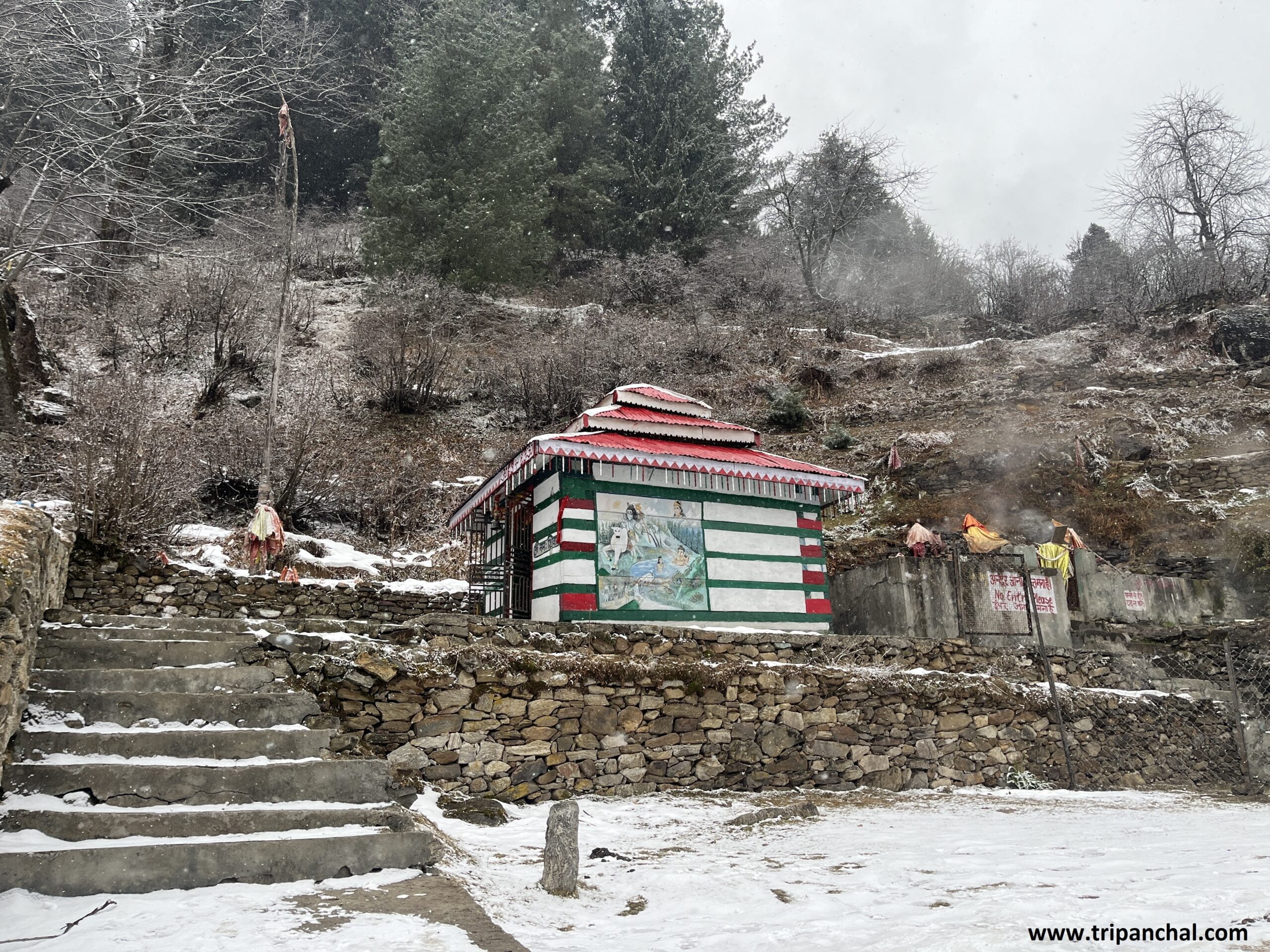
Kheerganga kasol
Kheerganga Mahadev Temple in winters

It is important to note that while the Kheerganga is classified as a moderate-level trek, it does require a certain level of physical fitness and endurance. The trek involves steep climbs and rocky terrain, which can be challenging for those who are not used to physical activity. Therefore, it is recommended to prepare for the trek at least a few days in advance by engaging in cardio and strength training exercises.

Things to keep in mind while traveling:

  • Do not roam alone at night. It’s not safe.
  • Respect Pahari culture and don’t argue/fight with people around you.
  • Do not litter in the mountains.
  • Save mountains, Save Nature.
  • Don’t do trekking with drugs.
  • Always carry a medical box, torchlight, trekking stick, trekking shoes, warm clothes, raincoat, and a water bottle with you.
  • Always walk carefully, Do not trek in bad weather.

FAQs

Q1: How to reach kheerganga from Kasol ?

You can take a local bus from the Kasol taxi stand to the Barshaini bus stand. The distance between Barshaini and Kasol is about 15.5 kilometers, which can be covered in approximately 1 hour of traveling time.

Q2: Where is Kasol Kheerganga ?

It is one of the best treks in the Parvati valley region and it is located at an altitude of approximately 9,711 feet in the Parvati valley near Barshaini village in the state of himachal Pradesh.

Q3: Is Kheerganga trek difficult?

Yes, Kheerganga trek is classified as a moderate-level trek, it does require a certain level of physical fitness and endurance. The trek involves steep climbs and rocky terrain, which can be challenging for those who are not used to physical activity. Therefore, it is recommended to prepare for the trek at least a few days in advance by engaging in cardio and strength training exercises.

Q4: Where to stay at Kheerganga ?

Yes, there are some accommodation options available at Kheerganga, ranging from homestays to camping. However, it is advisable to book in advance, especially during the peak season, to ensure availability. The booking link is available in the blog. Please check below.

Q5: Can I do Kheerganga trek in winters?

Try to avoid trekking during the monsoon & winter seasons when the trail becomes slippery and closed due to landslides and Heavy snowfall.

Q6: Barshaini to Kheerganga trek distance ?

The trek starts from the small village of Barshaini, which is accessible by road from the town of Kasol. Covering a distance of about 13 kilometers, the trek usually takes 5-6 hours to complete.

Q7: How to reach Kheerganga trek from Delhi?

Take a bus from New Delhi/Chandigarh to Kasol, then take a local bus from Kasol bus point to Barshaini bus point, then from Barshaini bus point towards the Kalga village you can start your trek.

Q8: Are mobile signals available in Kheerganga trek?

Network coverage is not proper at Kheerganga trek.

Q9: How Long is kheerganga trek ?

Approximately 13 kilometers.

Q10: Can women and kids do Kheerganga trek ?

Yes, but the recommended Age Level is below mentioned

Kids: Above 14 Years

Women: Less than 50 Years

By clicking on the below link, you can book a room in the homestay/Camping according to your choice

Gipsi House

City Escape Camps and Cafe Kheerganga

Hilltop camping

Hotel Marigold-Pulga, contact: +916230036000

Cafe’s Nearby Kheerganga Kasol trek

Hilltop Cafe

Suryansh Cafe

Freedom kalga cafe

Book a Package for Kasol-Kheerganga Trek

Kheerganga Kasol trek with camping

Kedarnath Uttarakhand: A Divine Abode

  • Key Points: Kedarnath, Adi Shankaracharya, Guptkashi, Phata, Rudraprayag.
  • State: Uttarakhand, India.
  • Duration: 4 Nights 5 Days.
  • Altitude: 3,583 meters (11,755 ft).
  • Summer temperature: (15°C to 25°C)
  • Winter temperature: (-18°C to 0°C)
  • Best Time To Visit: April to October.
  • How to Reach: Take the General/Sleeper class Bus from Delhi to Rishikesh, then again change a bus or take a taxi from ISBT Rishikesh to Sonprayag, and now again take a taxi from Sonprayag to Gaurikund. From Gaurikund you can start your trek.
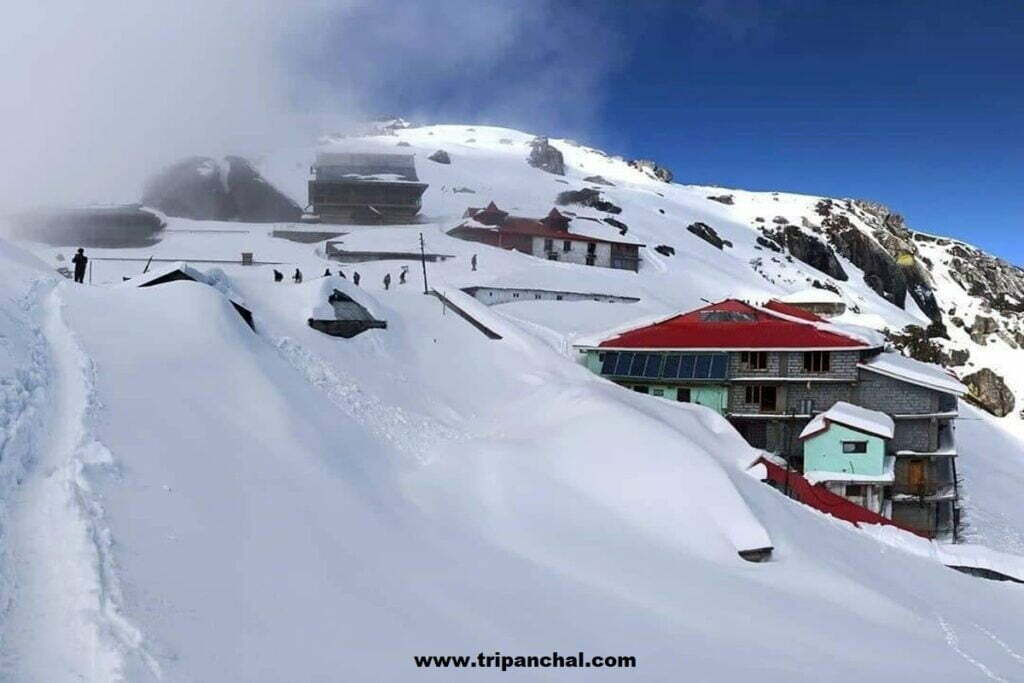
  • Budget: ₹7000-₹8000 Per Person.
  • Weather: In winter, Snow covers the peaks and in the summers you can experience a cool breeze.
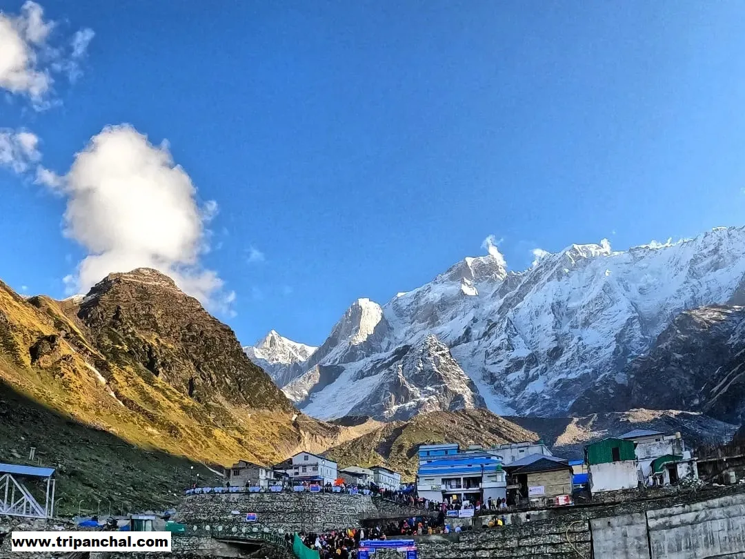
Kedarnath uttarakhand
Chorabari Glacier behind Kedarnath Temple

Introduction

Kedarnath Uttarakhand, a revered destination for pilgrims and nature enthusiasts alike, is a place where spirituality merges seamlessly with nature’s magnificence. It is located in the state of Uttarakhand in northern India. This article delves deep into the captivating charm of Kedarnath Uttarakhand, exploring its significance, natural wonders, and spiritual essence.

Kedarnath Uttarakhand

The allure of Kedarnath Uttarakhand lies in its sacredness and historical significance. This temple is dedicated to Lord Shiva, one of the most revered deities in Hindu mythology. This temple holds immense spiritual importance and is one of the twelve Jyotirlingas, believed to be the holy abodes of Lord Shiva.

Kedarnath: A Marvel of Architecture

The Kedarnath Temple stands as a testament to the architectural brilliance of ancient times. Dating back over a thousand years, the temple showcases intricate stone carvings and craftsmanship that have withstood the test of time. Pilgrims from around the world visit this sacred shrine to seek blessings and immerse themselves in its divine aura.

Kedarnath Uttarakhand
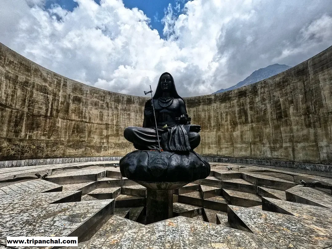
Adi Shankaracharya Ji Statue behind Kedarnath Temple

Story of Kedarnath Uttarakhand
According to ancient Hindu mythology, Lord Shiva took refuge in Kedarnath after the great battle of Kurukshetra the Pandavas seeking salvation sought the blessings of Lord Shiva to free them from their sins. In response Lord Shiva disguised himself as a bull and took refuge with Lord Kedarnath The temple is considered to mark the place where Lord Shiva revealed his true nature to the Pandavas, thus granting them salvation.

Kedarnath Uttarakhand
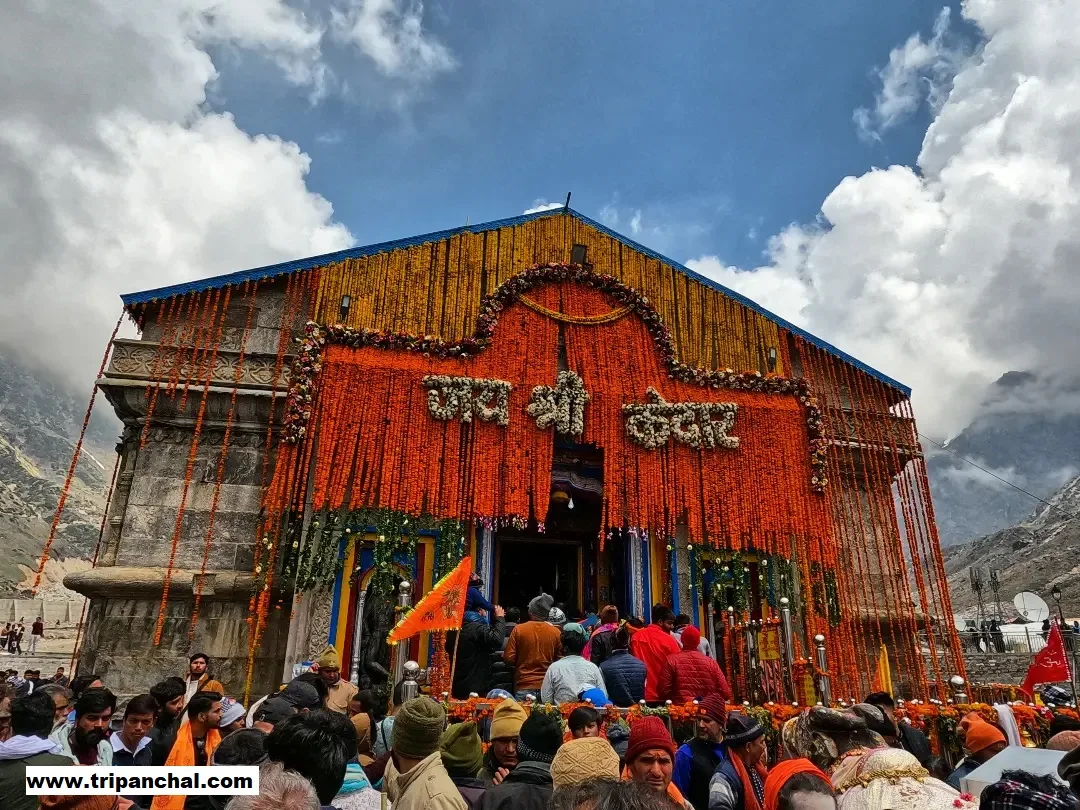
Opening Ceremony of Kedarnath Uttarakhand

Natural Wonders of Kedarnath Uttarakhand

Kedarnath, Uttarakhand is not just a spiritual haven but also a treasure trove of natural beauty. From snow-clad peaks to cascading waterfalls, the region offers a visual extravaganza for nature lovers.

Majestic Himalayan Peaks

As Kedarnath is nestled in the heart of the Himalayas, the town boasts awe-inspiring views of towering peaks. The majestic Kedarnath Range, with peaks like Kedarnath, Kedar Dome, and Bharatekuntha, forms a breathtaking backdrop for the town. Witnessing the first rays of the sun painting the snow-capped mountains in hues of gold is an experience that words fail to capture.

Kedarnath Uttarakhand
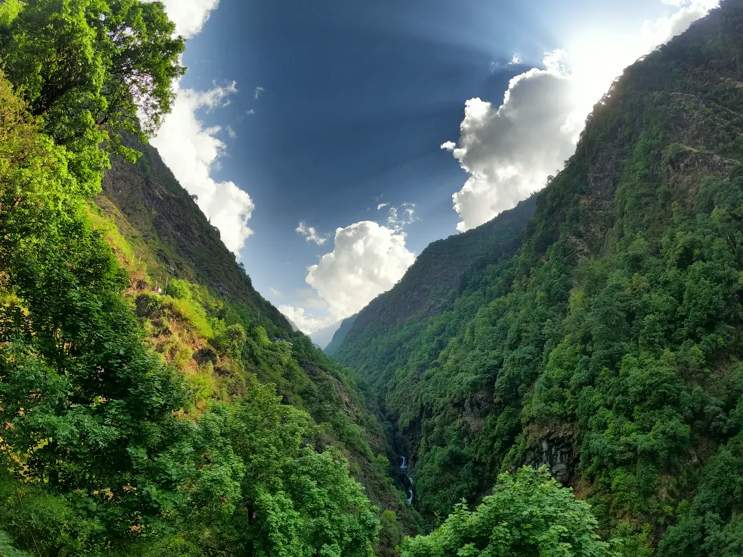
Kedarnath Wildlife Sanctuary

Enchanting Meadows and Valleys

The meadows and valleys surrounding Kedarnath are a sight to behold. The verdant meadows of Chopta, popularly known as the “Mini Switzerland of India,” offer a tranquil retreat. The valley of flowers, nestled in the Nanda Devi Biosphere Reserve, blooms with a vibrant tapestry of flora, showcasing nature’s artistry at its best.

Rudraprayag: The Serene Confluence of Sacred Rivers
As you make your way toward Kedarnath, a visit to Rudraprayag is an absolute must. Situated at the confluence of the Alaknanda and Mandakini rivers, Rudraprayag is considered a sacred site. The rhythmic sound of the flowing waters creates a serene ambiance, perfect for meditation and introspection. Take a moment to immerse yourself in the tranquil atmosphere and witness the harmonious union of these sacred rivers.

Spiritual Significance and Pilgrimage Experience

The journey to Kedarnath is not just about visiting a religious site; it is a transformative pilgrimage experience that touches the soul of every traveler.

Kedarnath Uttarakhand
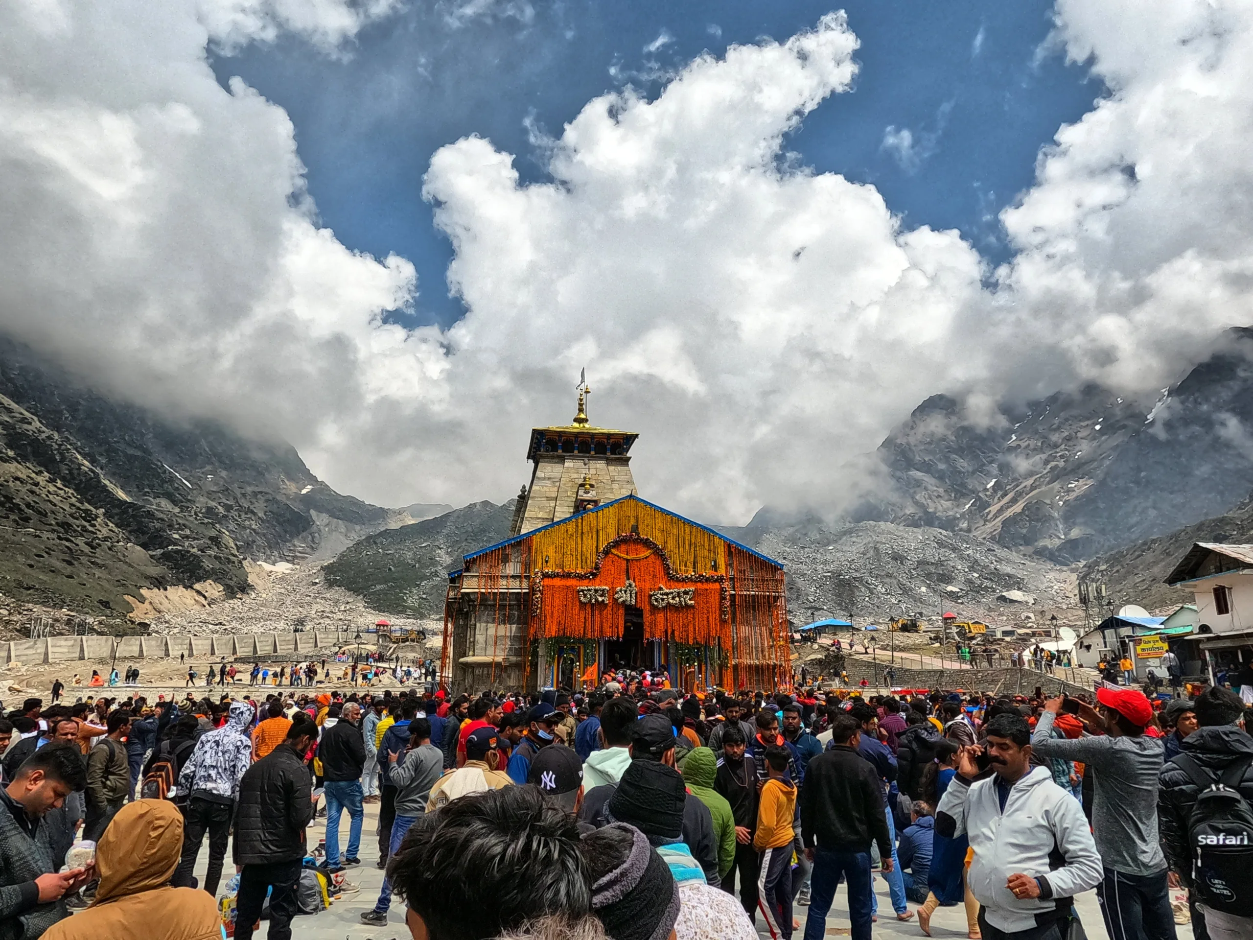
Majestic View of Kedarnath Temple

Trekking to Kedarnath: A Test of Faith

The traditional way to reach Kedarnath is through a challenging trek that spans approximately 24 kilometers. The trek, often undertaken by devotees, weaves through rugged terrains and offers panoramic views of the surrounding mountains. It is believed that the journey tests one’s devotion and strengthens their connection with the divine.

Kedarnath Uttarakhand

Rudra Meditation Cave: Seeking Solitude

For those seeking a deeper spiritual experience, the Rudra Meditation Cave near Kedarnath provides a serene sanctuary. This sacred cave is where Lord Shiva meditated for thousands of years. Meditating in this cave allows visitors to delve into a state of tranquility and connect with their inner selves.

FAQs

Q1: Which month is best to visit Kedarnath ?

The best time to visit Kedarnath Uttarakhand is during the summer months of May to June and the autumn months of September to October. These seasons offer pleasant weather and clear skies, making it easier to undertake the pilgrimage and enjoy the natural beauty.

Q2: How to reach Kedarnath from delhi ?

To reach Kedarnath Uttarakhand, one needs to travel to the nearest airport, Jolly Grant Airport in Dehradun, or the railway station at Rishikesh. From ISBT Rishikesh, you can hire a cab or take a bus to Gaurikund, towards the base camp for the trek to Kedarnath.

Q3: Is the trek to Kedarnath Uttarakhand difficult?

The trek involves steep climbs and rocky terrain, which can be challenging for those who are not used to physical activity. Therefore, it is recommended to prepare for the trek at least a few days in advance by engaging in cardio and strength training exercises. It is advisable to prepare oneself physically and mentally before undertaking the trek.

Q4: Where to stay in Kedarnath ?

Yes, there are several accommodation options available in Kedarnath, ranging from guesthouses and Dharamshala to resorts. However, it is advisable to book in advance, especially during the peak pilgrimage season, to ensure availability.

Q5: Can I visit Kedarnath Uttarakhand in winter?

Kedarnath experiences harsh winters with heavy snowfall, making it inaccessible for most travelers. The temple and the town remain closed during this period. It is advisable to plan your visit between the months of May and October to avoid extreme weather conditions.

Q6: Is photography allowed inside the Kedarnath Temple?

No, Photography is not allowed inside the Kedarnath Temple. Requested visitors to respect the sanctity of the temple and adhere to the rules and regulations.

Q7: Kedarnath opening date 2024?

Kedarnath opening ceremony will be held on 10th May 2024.

Q8: Panch kedar opening date 2024?

Kedarnath- 10th May 2024.

Madhyamaheshwar- 20th May 2024.

Tungnath- 10th May 2024.

Rudranath- 18th May 2024.

Kalpeshwar- Open all year round.

Things to keep in mind while traveling:

  • Do not roam alone at night. It’s not safe.
  • Respect Pahari culture and don’t argue/fight with people around you.
  • Do not litter in the mountains.
  • Save mountains, Save Nature.
  • Always carry a medical box, torchlight, trekking stick, Shoes, Warm clothes, and a water bottle with you.
  • Always walk carefully, Do not travel in bad weather.

By clicking on the below link, you can book a room in the Homestay/Hotel according to your choice

NeelanshResort-Sonprayag

Hotel kunj kedar

Bhopal Bhawan

GMVN Cottages

By clicking on the below link, you can book a helicopter ride

Kedarnath Helicopter Ride Booking

click on the below link for registration and Yatra E-Pass

char dham registration link

Restaurants Nearby Kedarnath Uttarakhand

Hotel Mandakini- Sonprayag

Tiwari Restaurant

Chitkul Himachal Pradesh 172109

  • Key Points: Chitkul, Sangla, Kinnaur, Karcham-Wangto Dam, Rakchham, Indo-Tibet Border.
  • State: Himachal Pradesh, India.
  • Duration: 6 Nights 5 Days.
  • Altitude: 3450 m (11,320 ft).
  • Summer temperature: (6°C to 15°C)
  • Winter temperature: (-3°C to -21°C)
  • Best Time To Visit: May to October.
  • How to Reach: Take the Local/Private Bus from Delhi to Shimla, then again change bus from Shimla to Rampur Bushar and continue towards Jeori. Again change the bus from Jeori to Sangla-Chitkul Road and continue to Chitkul but we recommend taking a direct taxi from Shimla to Chitkul.
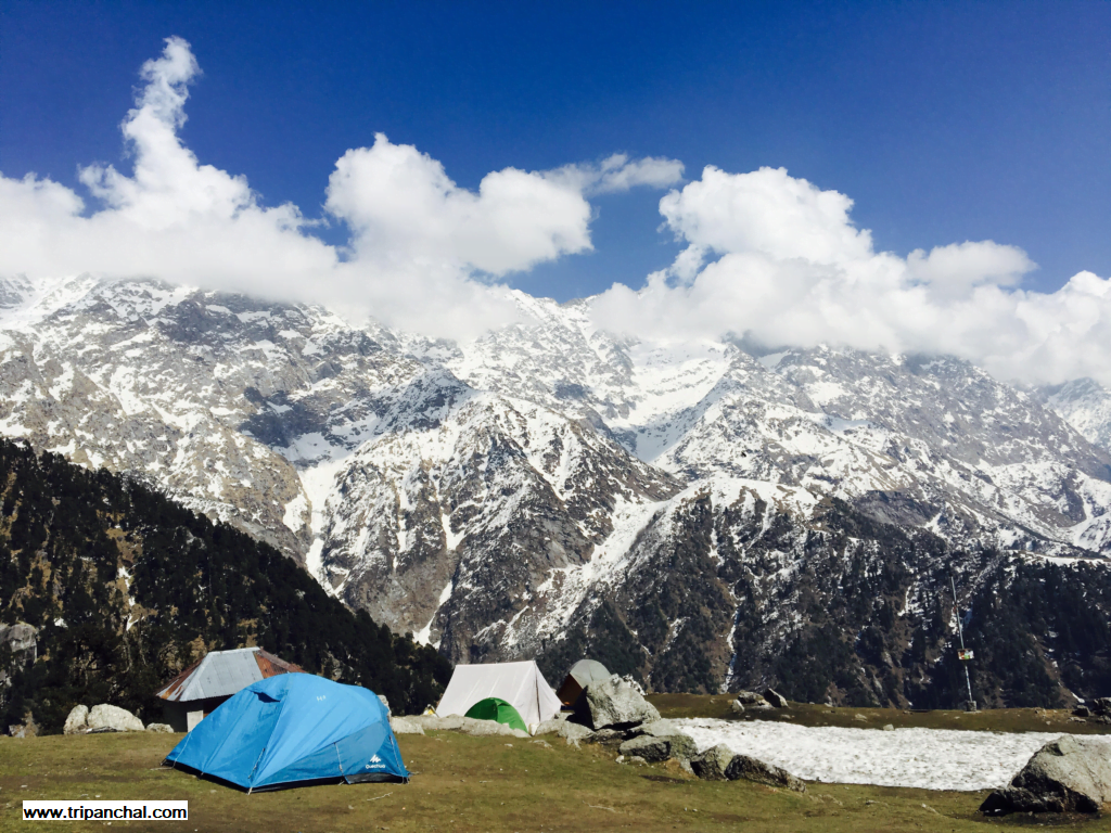
  • Budget: ₹7000-₹8,000 Per Person.
  • Weather: In winter, Snow covers the peaks and in the summers you can experience a cool breeze.
Chitkul Himachal Pradesh 172109
Stunning View of Baspa River

About Chitkul Himachal Pradesh 172109

Do you know about Chitkul Himachal Pradesh 172109 , which is also known as the last village of India?
‘Chitkul’ is a small village situated at 3450 m in the Kinnaur district of Himachal Pradesh. The population of this village is around only 1500. This village is only 75 kilometers away from the Indo-Tibet border, that’s why this village is known as the last village of India. The place is often covered with a blanket of white snow during the winter season, making this village one of the less traveled routes.

Chitkul Himachal Pradesh 172109
Chitkul in the winter season

‘Chitkul’ village is one of the hidden treasures and very few people know about it. This village situated near the baspa river and upstream from the river. To reach Chitkul, travelers can take a local government HRTC bus or take a private taxi to reach Chitkul. You can easily get taxis from Shimla, Rampur Bushar, Reckong Peo, or Sangla. The fastest way to reach Chitkul is by taking a taxi or hiring a motorbike from Shimla. The government bus is the most economical way to reach Chitkul village. The bike drive from Sangla to Chitkul is a delight for nature lovers, the bumpy road & meadows of Sangla make the valley more beautiful, and the Baspa River separates the snow-clad Himalayan peaks on the left side of Chitkul.

Here people cultivate apples and run their homes, here most of the houses are made of wood and stone. The local people here say that houses made of wood and stone protect the houses from earthquakes and lightning falling from the sky.

Chitkul Himachal Pradesh 172109
The last dhaba of Hindustan

Some interesting facts about the last village of India:

  • Chitkul village has no cell phone network coverage, no market, and no ATM.
  • Rather, you will have to shop from domestic shops to buy essential items here.
  • For travelers interested in street photography, this place is just like a Paradise.
  • The local people here are always ready to welcome you with a very calm nature.
  • The main occupation of the villagers here is either agriculture or animal husbandry.
  • The Chitkul area produces the best quality potatoes and supplies them across the country.
  • There are two schools in the village, the primary school is located inside the village and the middle school is located on the banks of the Baspa river. The electricity supply in the village is always sufficient.
  • In Chitkul, travelers can enjoy nature and the cool breeze together by hiking along the banks of the Baspa River. You can also experience trekking and camping in the forest surrounding the village.

Accommodations at the Chitkul Himachal Pradesh 172109

By the way, in Chitkul village you will find only a few guesthouses which are actually old houses converted into homestays. The village has guest houses and a few homestays which are run by the villagers. But recently some new hostels have been opened here which are run by the private company Zostel.

Most of the time staying in hostels is a very good option for young people and here you can stay at an affordable rate, a hostel room can accommodate up to 2 to 4 people in each room and the rate of per bed is around 500 rupees.

The village has very limited food options. Here you will get Maggi, Rice and Dal, Chowmein, and some other options for food. There is also the last dhaba of Chitkul on the Indo-Tibet border, whose name is ‘the last dhaba of Hindustan’. You can take your selfie with Dhaba which will be very memorable for you.

Chitkul is the hidden gem of India, the village does not offer much in terms of tourism, but it is a place that every traveler would love to visit and take back a lot of experiences.

Things to keep in mind while traveling:

  • Do not roam alone at night. It’s not safe.
  • Respect Pahari culture and don’t argue/fight with people around you.
  • Do not litter in the mountains.
  • Save mountains, Save Nature.
  • Always carry a medical box, torchlight, Walking stick, Shoes, Warm clothes, and a water bottle with you.
  • Always walk carefully, Do not travel in bad weather.

FAQs

Q1: How to reach Chitkul from delhi ?

Take the Local/Private Bus from Delhi to Shimla, then again change bus from Shimla to Rampur Bushar and continue towards Jeori. Again change the bus from Jeori to Sangla-Chitkul Road and continue to Chitkul but we recommend taking a direct taxi from Shimla to Chitkul.
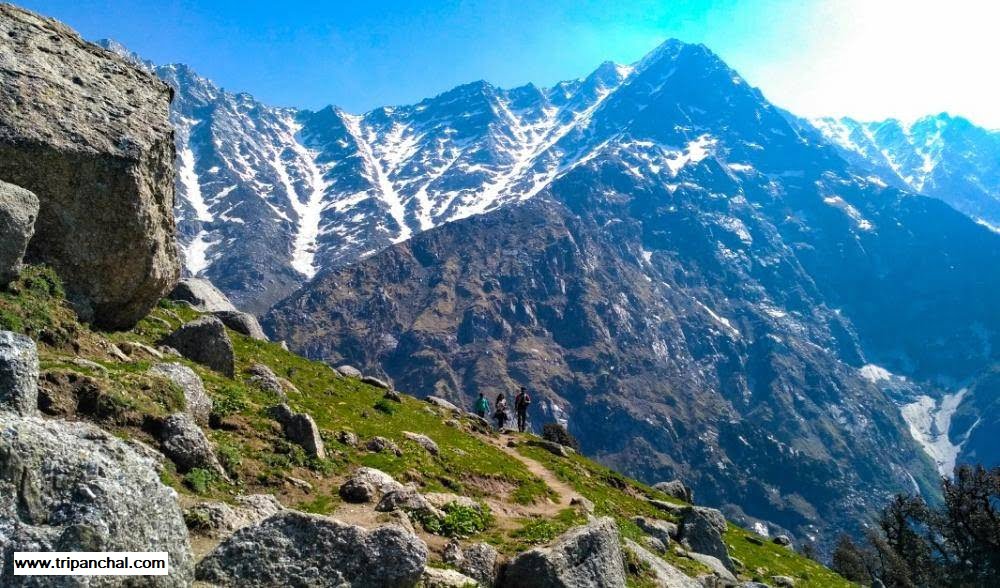
Q2: How to reach Chitkul from Mumbai ?

Take the direct flight or train from Mumbai to Chandigarh, then take a bus from Sector-43 bus stand to Shimla, then take a bus from Shimla to Rampur Bushar and continue towards Jeori. Again change the bus from Jeori to Sangla-Chitkul Road and continue to Chitkul but we recommend taking a direct taxi from Shimla to Chitkul.

Q3: Where to stay in Chitkul ?

Yes, there are some accommodation options available in Chitkul, ranging from hostels to guesthouses. However, it is advisable to book in advance, especially during the peak season, to ensure availability. Booking Link is available in this blog. Please check below.

Q4: Sangla to Chitkul Distance ?

Approximately 1 hr 9 min (23.3 km).

Q5: Chitkul Pincode ?

The pincode of chitkul is 172109.

Q6: Cleanest Air in India ?

According to a recent study by IIT Delhi, Chitkul has the cleanest air in india.

Q7: Places to Visit in Chitkul ?

There are several locations to explore in chitkul like: last indian village post office, Baspa river, Mathi Temple, Charang chitkul Pass, Chitkul Wildlife Sanctuary, The last Dhaba of Hindustan, The last government school of India at indo-tibbet border.

By clicking on the below link, you can book a room in the Hostel/Resort according to your choice

Zostel-Chitkul

Zostel- Sangla

Zostel Homes Rakchham

Cafe’s Nearby Chitkul Himachal Pradesh 172109

Mickey’s Cafe

Hindustan Ka Aakhri Dhaba

Cafe Chitkool

Kareri Lake Trek, Dharamshala

  • Key Points: Dharamshala, McLeod Ganj, Ghera Village, Kareri Village, Niyund River, Nioli Village.
  • State: Himachal Pradesh, India.
  • Duration: 3 Nights 4 Day.
  • Altitude: 2,934 m (9,626 feet).
  • Trek Distance: Approximately 13 kms.
  • Summer temperature: (15°C to 25°C)
  • Winter temperature: (-7°C to 5°C)
  • Best Time To Visit: May – November.
  • Trek Level: Moderate.
  • How to Reach: Take a bus from New Delhi/Chandigarh to Dharamshala/Mcleod Ganj, then take a local bus/taxi from Dharamshala or Mcleod Ganj to Kareri Village, then start your trek from kareri village.
  • Budget: Under ₹6000-7000 per person.
  • Weather: In winter, Snow covers the peaks and in the summers you can experience a cool breeze.
Kareri Lake_ Kareri lake trek
Kareri lake in winters

Kareri Lake

The Kareri lake is one of the most adventurous & scenic trek in the Kangra district of Himachal Pradesh. This trek is a great option for the ones who love to explore the beauty of mountains. Its stunning natural beauty, serene atmosphere, and panoramic views of the Himalayan mountains are what make this trek well-known. This trek is not an easy option for those who do not prefer to walk much or who are not used to physical activity.

About Kareri Lake Trek

The Kareri Lake Trek starts from the Kareri Village which is easily accessible by road from Dharamshala and Mcleod ganj. This village is located at an altitude of 5900 ft from sea level and it takes you through a scenic trail which is surrounded by the dense forest of Oak and pine trees. In between the treks you will found the several little waterfalls, meadows & dense forest.

This trek offers you stunning views of the Dhauladhar mountain range and you can also spot some wildlife animals like Himalayan black bear or leopard, If you are lucky. The Kareri Lake Trek can be an adventure, but it is essential to understand the risks involved in attempting it during the rainy season.

Kareri Lake_ Kareri lake trek
Stunning view of kareri lake

As you climb higher, the view of the Dhauladhar range becomes more spectacular, with snow-capped mountains in the distance. The last part of the trail is quite steep, but the view from the top makes it all worthwhile. The mountains surrounding the Kangra Valley below are truly breathtaking. The glacial lake view of kareri lake is one of the highlights of this trek, travelers can do overnight camping at the top for viewing across the lake but we recommend you to stay in any lodge, hostel or homestay. Because at peak there is a chance of snow storm or heavy snowfall which will damage your tents/camps.

Kareri Lake_ Kareri lake trek
Temple located at Kareri lake

After exploring the lake, You can go back to the kareri village and marking the end of the trek and during the return time from the trek, Do not forget to enjoy the hostel stay at Zostel Plus Kareri.

Important Note:

Anyone with a moderate level of fitness can complete the kareri Lake Trek, as it is suitable for both beginners & experienced trekkers. However, it’s important to carry the trekking equipment’s and other trekking gears for the enjoyable experience. The best time to visit the trek is from May to November, when the weather is relatively normal and clear but avoid the rainy season. Because at that time there is a chance of landslide. So, Plan your journey accordingly.

Things to keep in mind while traveling:

  • Do not roam alone at night. It’s not safe.
  • Respect Pahari culture and don’t argue/fight with people around you.
  • Do not litter in mountains.
  • Save mountains, Save nature.
  • Don’t do trekking with drugs.
  • Always carry a medical box, torchlight, trekking stick, trekking shoes, warm clothes, and a water bottle with you.
  • Always walk carefully, Do not trek in bad weather.

By clicking on the below link, you can book a room in the hostel/Camping according to your choice

Zostel Plus- Kareri (Recommended one for Kareri lake Trek)

Zostel-Mcleod Ganj

The hosteller- Mall Road, Mcleod Ganj

Cafe’s Nearby Mcleod Ganj

Shiva Cafe- Mcleod Ganj

Carpe Diem Restaurant

Jimmy Italian

Churdhar Trek, Sirmaur

  • Key Points: Churdhar Peak, Sirmaur, Jam Nallah, Lord Shirgul Maharaj, Chooreshwar Mahadev.
  • State: Sirmaur, Himachal Pradesh, India.
  • Duration: 2 Nights 3Days.
  • Altitude: 3,647m (12,00 feet).
  • Trek Distance: Approximately 18 km from Nohradhar.
  • Summer temperature: (10°C to 20°C)
  • Winter temperature: (-10°C to 5°C)
  • Best Time To Visit: May to November.
  • Trek Level: Moderate.
  • How to Reach: Take a bus from New Delhi to the Chandigarh bus stand then take a bus/taxi from Chandigarh to the Solan stand, again take a local taxi from Solan to Nohradhar, then from Nohradhar, you can start your trek.
  • Budget: Under ₹ 6000-7000 per person.
  • Weather: In winter, Snow covers the peaks and in the summers you can experience a cool breeze.

Churdhar Trek

‘Churdhar trek’ is a majestic mountain situated in the Sirmaur district of Himachal Pradesh at an elevation of 3,647 meters, It is one of the highest peaks of the Shivalik range of the Himalayas. The peak is also known as ChuriChandni, which means ‘mountain of the snow bangle’ in the local language.

churdhar trek
Chooreshwar Mahadev Temple At Churdhar Peak

The trekking route to Churdhar peak starts from the small town of nohradhar, which is around 45-50 Km from Solan. Nohradhar is a small town, surrounded by lush green forests and hills. It is a perfect place to start your trek and immerse yourself in the beauty of nature. The treks from nohradhar winds up through dense forests of deodar, oak, and rhododendron trees. The Treks offer beautiful views of the surrounding hills and valleys and provide trekkers with an opportunity to experience the natural beauty of the region.

About Churdhar Trek

The trek to Churdhar trek can be done throughout the year, except during the monsoon season when the trail becomes slippery and dangerous. The best time to visit the Churdhar trek is from May to November whenever the weather is pleasant and the skies are clear.

churdhar trek
Snow storm view at Jam Nallah

The ‘Churdhar trek’ is a moderate-level trek and it will take around 2-3 days to complete, depending on your physical fitness. The churdhar trek offers you an opportunity to immerse yourself in the beauty of the Himalayas, with breathtaking views of snow-capped peaks, verdant valleys, and charming mountain villages. The highlight of the trek is undoubtedly the picturesque churdhar peak, which offers a glimpse into the region’s rich cultural heritage and traditional architecture. Overall, the Trekking distance is around 18Kms from nohradhar and the trek involves trekking uphill for the first two days and hillside on the last day.

churdhar trek
Snowfall at Churhdar Trek

There are so many accommodations and food options available on the trip. You can do camping or stay in the guesthouses, available at various points along the trail. The food is simple and tasty mostly consisting of local dishes like dal, rice, chapatis, and vegetables. If you’re looking for a break from your daily 9-5 work life, Churdhar Trek is the perfect weekend getaway for you, and it’s easily accessible from Delhi/Chandigarh.

Things to keep in mind while traveling:

  • Do not roam alone at night. It’s not safe.
  • Respect Pahari culture and don’t argue/fight with people around you.
  • Do not litter in the mountains.
  • Save mountains, Save Nature.
  • Don’t do trekking with drugs.
  • Always carry a medical box, torchlight, trekking stick, tracking shoes, warm clothes, and a water bottle with you.
  • Always walk carefully, Do not trek in bad weather.

FAQs

Q1: What is the churdhar trek distance ?

The trek distance is approximately 18 km from Nohradhar, 45 km from Sarahan.

Q2: what is the churdhar trek height ?

The altitude of churdhar trek is 3,647m (12,00 feet).

Q3: Is trek to churdhar peak difficult ?

The trek involves steep climbs and rocky terrain, Which can be challenging for those who are not used to physical activity. Therefore, it is recommended to prepare for the trek at least a few days in advance by engaging in cardio and strength training exercises. It is advisable to prepare oneself physically and mentally before undertaking the trek.

Q4: Where to stay at churdhar trek ?

Yes, there are some accommodation options available at churdhar, ranging from guesthouses and hotels to resorts. However, it is advisable to book in advance, especially during the peak season, to ensure availability.

Q5: Can I do Churdhar trek in winters ?

This trek can be done throughout the year, except during the monsoon season when the trail becomes slippery and dangerous. The best time to visit the Churdhar trek is from May to November whenever the weather is pleasant and the skies are clear.

Q6: Nohradhar to churdhar trek distance ?

The trek distance is approximately 18 km from Nohradhar.

By clicking on the below link, you can book a room in the Hotel/Resort according to your choice

Hotel Chureshwar Resort

The Sirmaur Retreat- Sirmaur

Cafe’s Near by Churdhar Peak

Cafe XOXO- Solan

The Coffee Lodge- Solan

Triund Trek, Mcleod Ganj

  • Key Points: Triund Trek, Galu Temple, Bhagsunaag, McLeod Ganj, Shiva Cafe, Dharamkot.
  • State: Himachal Pradesh, India.
  • Duration: 2 Nights 2 Days.
  • Altitude: 2,875 m (9,432 feet).
  • Trek Distance: Approximately 9 Kms from Galu Temple.
  • Summer temperature: (10°C to 25°C)
  • Winter temperature: (-3°C to 5°C)
  • Best Time To Visit: All Year Round.
  • Trek Level: Easy to Moderate.
  • How to Reach: Take a bus from New Delhi/Chandigarh to Dharamshala/McLeod Ganj, then take a local taxi from McLeod Ganj stand to Galu temple, then from Galu temple, you can start your trek.
  • Weather: In winter, Snow covers the peaks and in the summers you can experience a cool breeze.

Triund Trek

The Triund trek is one of the most beautiful trek in the Dharmshala region of Himachal Pradesh. This trek is a great option for the ones who love to explore the nature. It is an easy trek for those who do not prefer to walk much but want to enjoy the trekking. It is a part of Dharamkot and it is situated at an altitude of 2875 meters at the base of the Dhauladhar mountain range.

triund trek
Stunning view of Dhauladhar Range

Right from the beginning of the trek, you can see the Moon Peak, Rifle Horn, Arthur Seat, and the Dhauladhar mountain range. The forest section of this trek is small, but the oak forests make the trekking route quite memorable. The Triund trek offers the enjoyment of both sunset and sunrise views. It is a very thrilling trek with captivating views of the Kangra valley and the snow-covered Dhauladhar mountain range.

About Triund Trek

The trek starts from the small town of McLeod Ganj, near Dharamshala, home of Tibet’s spiritual leader, the Dalai Lama. Anyone with a moderate level of fitness can complete the Triund Trek, as it is suitable for both beginners & experienced trekkers. The trekking distance is approximately 9 km long and takes about 4-5 hours to complete. The trail passes through dense forests of oak and deodar trees, and you can see the stunning 360° views of the surrounding mountain belt of the Dhauladhar.

triund trek
Enroute to Triund trek

As you climb higher, the view of the Dhauladhar range becomes more spectacular, with snow-capped mountains in the distance. The last part of the walk is quite steep, but the view from the top makes it all worthwhile. The mountains surrounding the Kangra Valley below are truly breathtaking. The sunset and sunrise views from triund are one of the highlights of this trek, travelers often stay overnight at the top for viewing Across Triund, there are a few shops and a dhaba (local restaurant).Where travelers can buy food and drinks. It is advisable to take some snacks and water as the stores can be expensive.

Information About Triund Trek Route

Right Now, There are two routes for Triund Trek. One is via Galu Temple and another one is via Shiva Cafe. Its totally up to you from where you want to go but we advise to go via Galu temple and come back via same route. Because Shiva cafe route is very steep and dangerous. So, better to avoid the shiva cafe route and during the return time from the trek, Do not forget to enjoy the hostel stay at zostel dharamkot.

triund trek
Enjoy the bonfire in Hostel

If you’re looking for a break from your daily hectic life, Triund trek and exploring Mcleod Ganj is the perfect weekend getaway, and it’s easily accessible from Delhi/Chandigarh.

Things to keep in mind while traveling:

  • Do not roam alone at night. It’s not safe.
  • Respect Pahari culture and don’t argue/fight with people around you.
  • Do not litter in the mountains.
  • Save mountains, Save Nature.
  • Don’t do trekking with drugs.
  • Always carry a medical box, torchlight, trekking stick, trekking shoes, warm clothes, and a water bottle with you.
  • Always walk carefully, Do not trek in bad weather.

By clicking on the below link, you can book a room in the Hostel according to your choice

Zostel-Dharamkot

Zostel-Mcleod Ganj

The hosteller- Mall Road, Mcleod Ganj

The hosteller- Bhagsu

Cafe’s Nearby Triund-Mcleod Ganj

Shiva Cafe- Mcleod Ganj

Carpe Diem Restaurant

Jimmy Italian

Exit mobile version